10:00AM VIDEO FORECAST from Meteorologist Scot Pilie — Temperature drop on the way! Risk for a few strong storms. Here’s the breakdown:
A strong spring-time cold front is en route to Southeast Louisiana and south Mississippi!
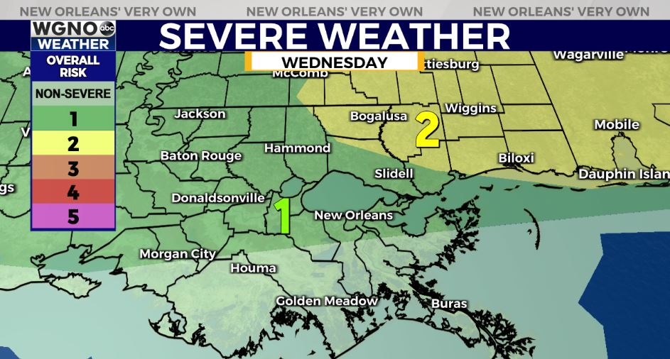
Risk for a few strong-severe thunderstorms, primarily north of I-10/I-12. Slight Risk(Level 2 out of 5) for strong storms into the eastern Northshore into south Mississippi.
Main risks of gusty winds, small hail, & isolated tornado. Arrival time Wednesday afternoon between 2PM-4PM from north to south.
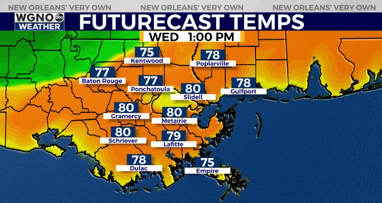
Ahead of the front, temperatures will climb into the lower 80s! Behind the front, temperatures will quickly fall 20-25 degrees into the upper 50s to the lower 60s.
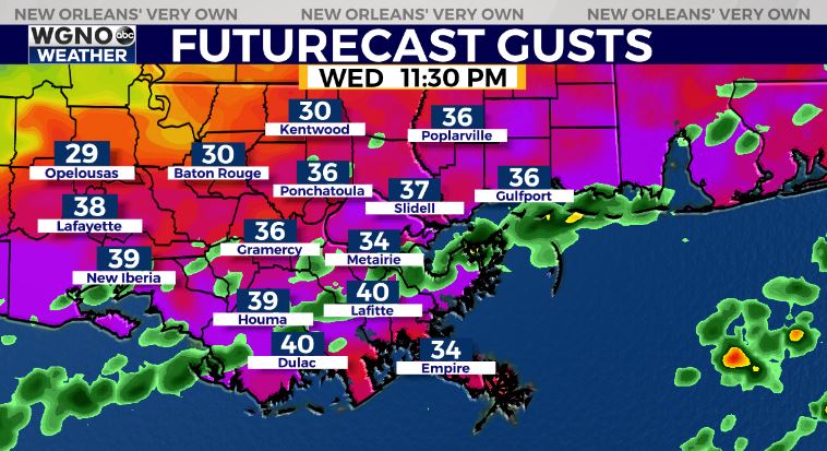
Winds behind the front will be gusty 25-40mph! Gusty winds 35-40+mph in the wake of this afternoon’s cold front. Wind advisory & Gale Warning issued until Thursday morning. Very choppy seas. Unexperienced mariners stay in safe harbor.
Winds will make the temps feel even colder!

Low temperatures in the lower 40s North, upper 40s-low 50s South.

MUCH cooler pattern on the way in the wake of the cold front Wednesday night-Saturday with high temperatures in the 60s! Low temps in the 30s in many spots north of the lake on Thursday night-Friday morning.


