
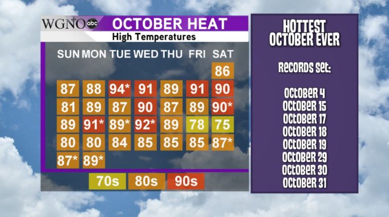
NEW ORLEANS (WGNO) – As October comes to a close, the heat, it seems, will continue to march on.
High temperatures over the weekend either tied the record (Sunday) or flat out broke it (Saturday and Halloween Monday). The thermometer topped out at 89 degrees on Monday marking the hottest Halloween in the city of New Orleans.
The month of October was unusually warm. In addition to eight days either setting or tying record highs, only two of the 31 days this month saw temperatures below average. High pressure has dominated the Southeastern U.S. over the past month-and-a-half and kept the rainfall and moisture away. This has allowed summer-like heat to continue into autumn.
As a whole, the month of October is almost 7 degrees warmer than average and will go down as the hottest October ever for the Crescent City.
In addition to the heat, a severe lack of rainfall has affected the area for the last two-and-a-half months as well.
Only .05′ of rain fell in October at Louis Armstrong International Airport. For most of us though, we didn’t see any rain during the month. The weather station at Audubon Park registered 0 inches of rain. Not a single drop fell there during the entire month.
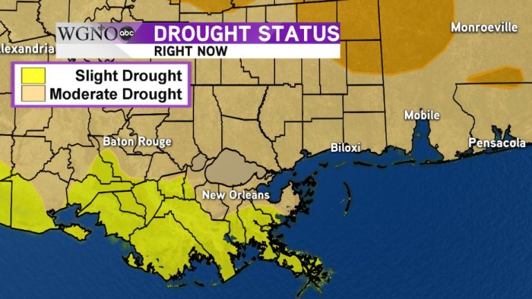
This dry spell has led to drought conditions developing across the region. Most of our viewing area is experiencing “moderate drought” conditions with the River Parishes and Louisiana Gulf Coast registering as “abnormally dry.”
With no additional rainfall in sight, we expect “severe drought” conditions to develop over the coming weeks.