NEW ORLEANS (WGNO) – It’s summer here along the Gulf Coast, and it seems the dog days have been a little rougher than usual. We may have had some showers roll through in the past week to help keep us relatively cool, but a drier and hotter pattern is set to arrive as a heat dome sets up across the majority of the country.
What is a heat dome?
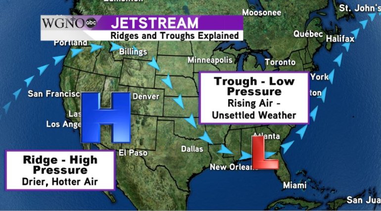
To better understand what a heat dome is, we need to talk about two different patterns in the jet stream, a high-speed tunnel of air high up in the atmosphere. The two patterns are a trough and a ridge as illustrated in the image below:

Typically in a trough, when the jet stream makes a dip into a region, there is relatively unsettled weather: showers, storms, sometimes breezy conditions. This is because low pressure tends to set up in these troughs.
Low pressure is associated with rising air, which is exactly what you need for precipitation to develop. On the flip side, in a ridge, when the jet stream bulges northward, folks south of the jet will see sinking air. This sinking air inhibits precipitation.
Additionally, the higher pressure compresses the air, which in turn causes it to heat up quicker. While most of the time a ridge like this will be referred to as a heat wave, when temperatures are expected to be well outside of the averages, it is referred to as a heat dome because of the shape the pressure gradient of the atmosphere makes.
What does this mean for us?
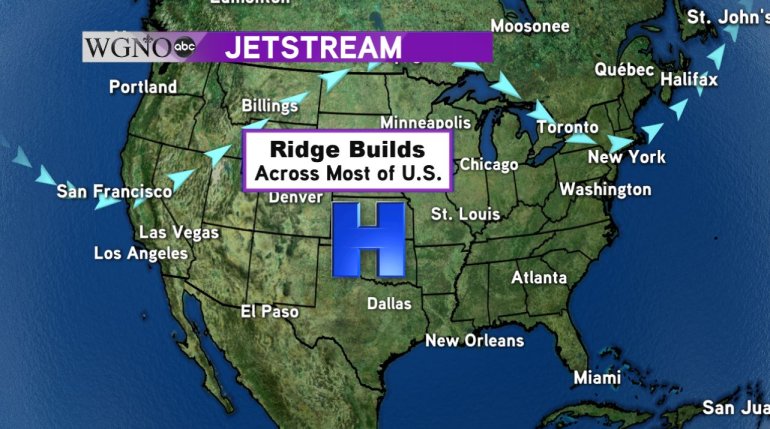
A massive ridge in the jet stream and large high-pressure system building over Texas mean the majority of the country will be seeing temperatures well above average, including us here along the Gulf Coast. High temperatures in New Orleans will slowly increase throughout the week into the middle 90s by Thursday, while the North Shore could be approaching 100 degrees. Combined with dewpoints in the middle 70s, heat index values will be 105 to 110, which is considered dangerous.

What happens in dangerous heat?
If proper precautions aren’t taken when the heat index approaches 105 and higher, several heat-related illnesses can set in.
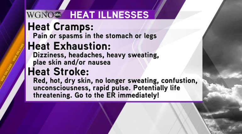
Typically, the first sign your body is in trouble comes in the form of heat cramps which is a pain or spasm in the stomach or legs. When your body is struggling to maintain its core temperature, symptoms such as dizziness, headaches, heavy sweating, pale skin, nausea or dizziness can set in as the body diverts resources to try and keep itself cool. These are the symptoms we are talking about when discussing heat exhaustion.
If you aren’t able to cool off the body at this point, heat stroke can set in. Heat stroke is potentially life-threatening, and medical help should be sought immediately if you experience: red, hot, dry skin and no sweating, body temperature above 103, rapid pulse, confusion and/or unconsciousness.

How can I keep myself healthy in the heat?
To keep your body temperature down and give it the tools it needs to stay cool, there are a few things you can do:
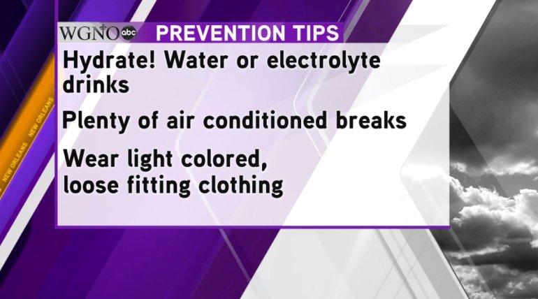
· The first is to hydrate! Sweating is the body’s natural way of staying cool, but you’re also losing fluids as you sweat. Drinking plenty of water and other electrolyte drinks ensures that you have enough fluids to keep sweat production going.
· Remember to take plenty of air-conditioned breaks indoors. By getting indoors where the temperature is less than 80 degrees, you allow your body to recover in a cooler environment which will bring your body temperature back down to normal in a much quicker time frame.
· Wear light-colored, loose fitting clothing. Lighter color clothing reflects more light away from you while darker colors absorb more. The darker the clothing, the more heat your clothes, and in turn your body, is absorbing.
· If you know you are going to be outdoors for long periods of time, plan ahead by eating light meals. Heavy meals with a lot of protein are harder to digest and take more energy. By substituting some healthy carbohydrates, you can digest your meals easier, and your body will have more energy to keep its cooling mechanisms going.


