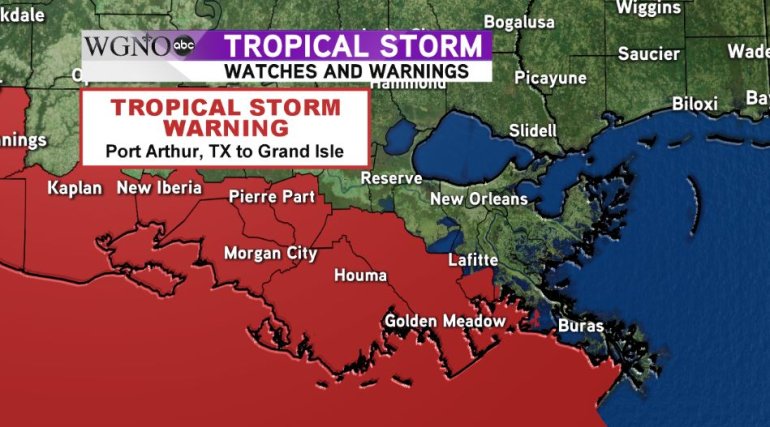
NEW ORLEANS – As Tropical Storm Harvey makes landfall west of Cameron, Louisiana, a tropical storm warning continues for portions of the Louisiana Coastline.
A tropical storm warning is in effect from Port Arthur, TX eastward to Grand Isle and now includes offshore waters to the mouth of the Mississippi River. A tropical storm warning means tropical storm force winds are expected in the warning area within 36 hours and tides can be expected to be above average causing some coastal flooding.
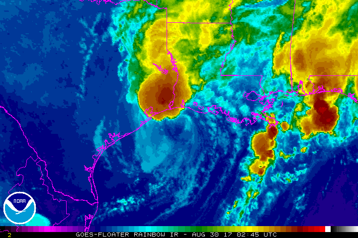
Drier air that has been wrapped into the eastern side of the system is trying to enter the area but is having a hard time doing so. Because of this, rain bands won’t be as widespread today, but as we saw overnight in New Orleans, the rains that do move through still have the potential to cause localized flooding.
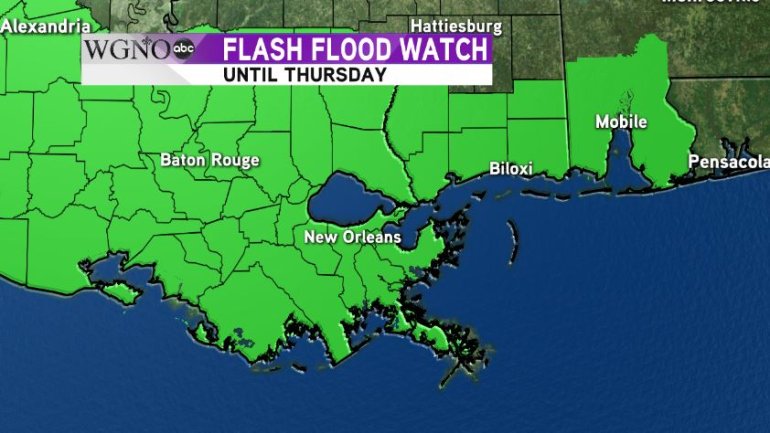
Widespread amounts of over 4″ have been reported across the region and the ground remains saturated. More heavy rain is possible and a flash flood watch remains in effect for our entire viewing area until Thursday.
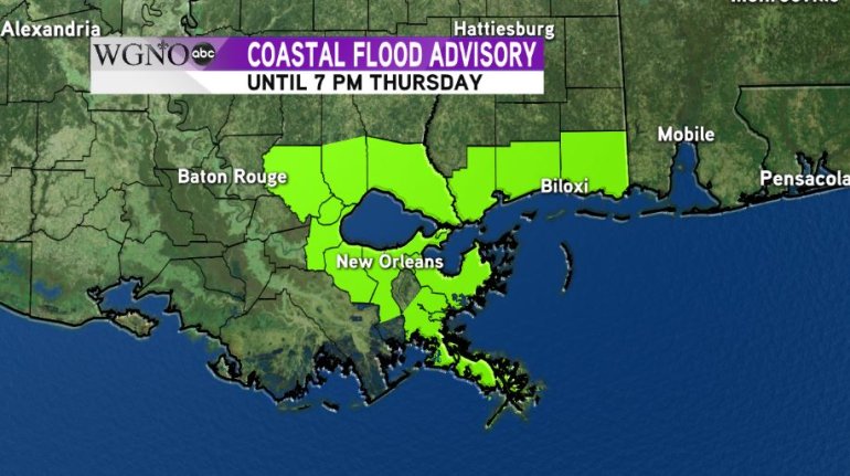
Since we are on the eastern side of the storm, an onshore flow of 20-30 mph remains along the Gulf Coast and Lake Ponchartrain. Because of this, tides can be expected to be 1-2 feet above average and a coastal flood advisory has been issued due to the possibility of flooding.
Please note, that while Terrebonne and Lafourche Parishes are not included in the map below, the coastal flood threat is there and is covered by the tropical storm warning mentioned above.
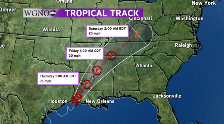
Harvey is expected to continue to move northeast through the center of the state. By Thursday, Harvey will finally be picked up by an incoming trough and move quickly out of the region, reaching Kentucky by Saturday morning.
As Harvey leaves the Southeastern U.S., our forecast will return to a more summer like pattern with scattered showers and storms with highs in the middle to upper 80s for the Labor Day Weekend.