A very cold few days are in store now that a strong cold front has moved through the area.
A Winter Weather Advisory is in effect from 6 PM tonight until noon on Friday for all areas shaded purple for the possibility of wintry precipitation. However, the threat for freezing rain or sleet potential looks minimal due to warm air aloft and a lack of moisture in the atmosphere.
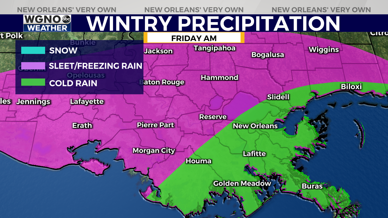
Any wintry precipitation that does fall will likely leave only trace amounts or very minimal accumulation of sleet or ice. The areas most likely see either freezing rain are west and north of Lake Pontchartrain. Bridges and elevated surfaces will be at the highest risk for freezing potential late Thursday night through Friday morning.
Overnight temperatures will likely be in the lower to mid 30s for the northshore, and mainly in the mid 30s for the southshore. Friday night into early Saturday morning will be even colder with temperatures dropping into the mid 20s for areas north and west of Lake Pontchartrain with areas south seeing the lower 30s.
Remember to protect people, pets, pipes, and plants from the cold weather for the next few nights!