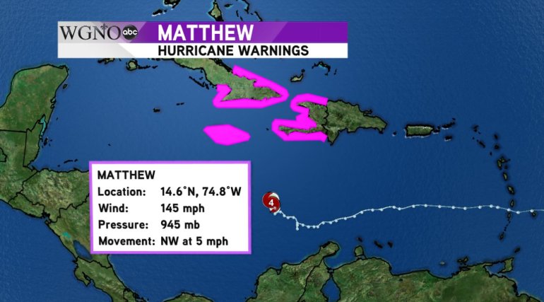
NEW ORLEANS (WGNO) – Hurricane Matthew, a dangerous category 4 storm, has made its turn to the north and has set Jamaica, Haiti and Cuba in its sight. Maximum sustained winds were at 145 mph with gusts up to 170 mph as of the last advisory at 10 p.m. Sunday night.
The winds with Matthew remain relatively compact with hurricane force winds extended up to 35 mph from the center of the storm. Matthew has weakened slightly since attaining Category 5 status late Saturday night. Matthew was the first Category 5 hurricane in the Atlantic basin since Felix in 2007 and strengthened from a tropical storm to a Category 5 hurricane in only 36 hours.
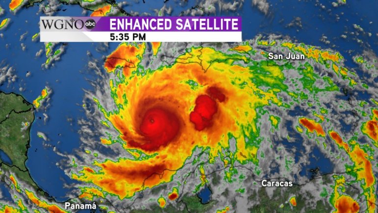
Satellite imagery showed the eye wall of Matthew returning overnight after become obscured for several hours Sunday afternoon. Matthew is forecast to pick up speed and move north towards the Greater Antilles. Hurricane warnings are now in effect for the entire coastlines of both Jamaica and Haiti and for eastern Cuba.
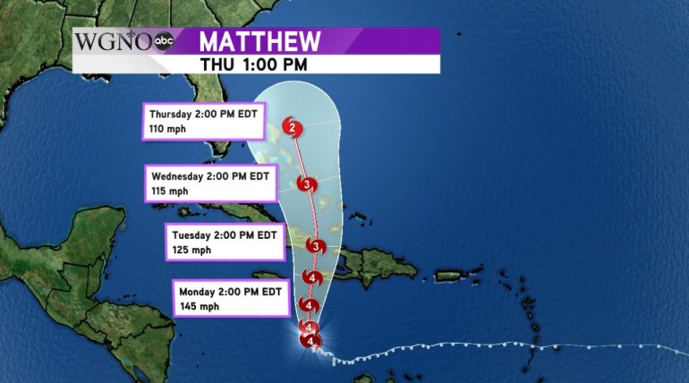
Matthew is expected to brush or even make landfall in extreme Southeastern Haiti as a strong and dangerous Category 4 storm with winds of 145 mph Monday night. Beyond Haiti, the forecast calls for Matthew to continue on into extreme Eastern Cuba Tuesday afternoon as a major hurricane with winds of 125 mph and continue into the Bahamas with winds of 115 mph by Wednesday.
The confidence in the forecast track is fairly high within 48 hours keeping the storm along a path towards Haiti, Jamaica and into Cuba. Beyond 48 hours, the confidence in the track begins to lessen, and it is still uncertain at this time what the impacts of Matthew will be along the Eastern U.S. seaboard.