
NEW ORLEANS- Today we head close to the 70’s with a chance for severe storms Saturday morning. We can see a line of storms with a cold front. That’s going to move into the city around 10am and then quickly move out of here by lunchtime. After that, remember how I said cold front? We are definitely going to feel that cold on Sunday!
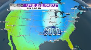
Morning lows will plummet into the 30’s and maybe even the freezing mark in the North shore. We are going to watch that as things progress though. So, Sunday is the huge game, but pack that heavy coat and ladies get those ponytails ready. It’s going to be an Arctic blast only in the 40’s and its going to be really windy after that front. That’s why we have a wind advisory in effect as well. So, tailgating may not be so pleasant with the wind and the cold air. But, that’s not stopping the Who Dat spirit!
So, for the 7 day forecast we are warm in the 60’s, storms come in Saturday morning. That arctic blast will be here for the game on Sunday. We warm up a little bit for MLK day. Then we have another cold front by Wednesday. So, the cold isn’t done just yet. One more thing you can see this week is the total lunar eclipse on Sunday if you can stand the cold. You’ll just have to stay up a little later at 11:12 at night to see the maximum eclipse. Send pics of that if you can to pics@digital-stage.wgno.com!
Follow and “Like” Adam Bowles on Facebook and Instagram for more weather updates and adventures!


