NEW ORLEANS (WGNO) – Another week and another busy time for the tropical Atlantic as the National Hurricane Center (NHC) is tracking three systems including a new depression that needs to be watched as it moves across the open waters towards the Antilles islands.
Tropical Depression 12
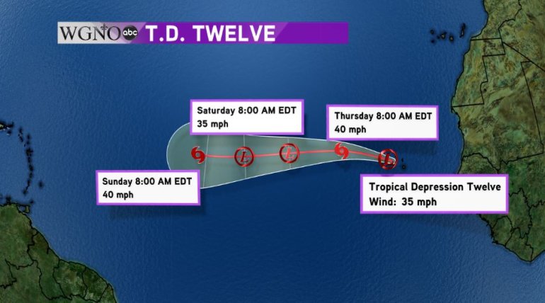
The NHC started issuing advisories on tropical depression 12 this morning as the system finally developed a closed center of circulation. As of 10 a.m. Central time, the depression was located 95 miles NW of the Cabo Verde Islands, an island chain off the western coast of Africa. This system is very far out to sea and more than a week away from impacting the Caribbean if it even heads that way. Winds were at 35 mph and the depression is expected to intensify into Tropical Storm Karl later today or early tomorrow. However, the system is likely to encounter strong wind-shear and cooler waters in a few days which may lead to the storm degenerating back into a depression and possibly a tropical wave. If it survives, the system could be near the Antilles by early next week.
Tropical Storm Julia
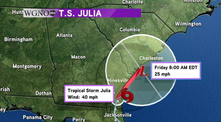
Julia quickly formed Tuesday evening while the center of circulation was actually inland over northern Florida. While rare, this has happened before. In fact, the last time a tropical system formed inland over the United States was when Beryl formed over Lake Pontchartrain in August of 1988. A very weak tropical storm, the main threats from Julia are heavy rains and flooding as it slowly moves north. Julia is located over Brunswick, Georgia and was maximum sustained winds of 40 mph.
Julia is expected to weaken back to a depression later today or tomorrow and eventually stall out near the Charleston, SC area. This could lead to intense rainfall and flash flooding over the Georgia an South Carolina coastlines for days to come.
Tropical Storm Ian
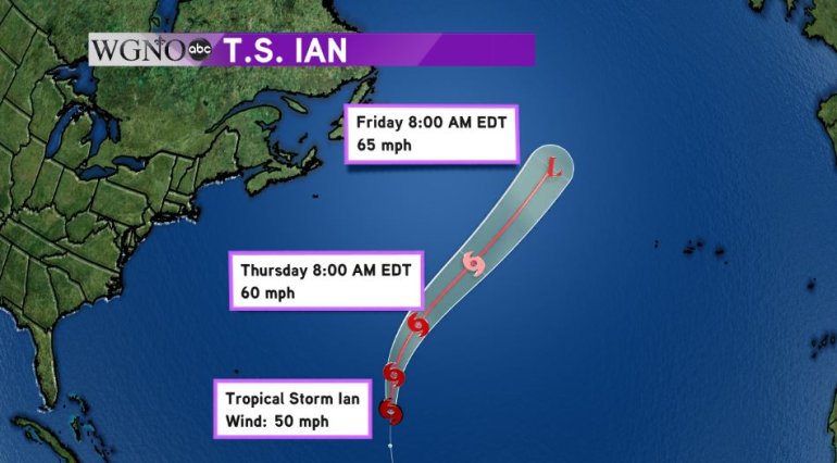
Meanwhile, the most organized storm in the Atlantic, Tropical Storm Ian, is staying well out to sea. Moving north at 20 mph and with maximum sustained winds of 50 mph, Ian is expected to lose its tropical characteristics later in the week as it encounters cooler waters and transition into a post-tropical cyclone. Ian could impact the British Isles as a low pressure system by the end of the weekend.


