8:30AM FORECAST — Areal Flood Advisory for Metro New Orleans. Watch for street flooding! Here’s the details:
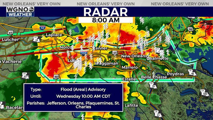
AREAL FLOOD ADVISORY — Issued for Metro New Orleans until 10:00AM. 1-3″ of rainfall possible, park vehicles in high location
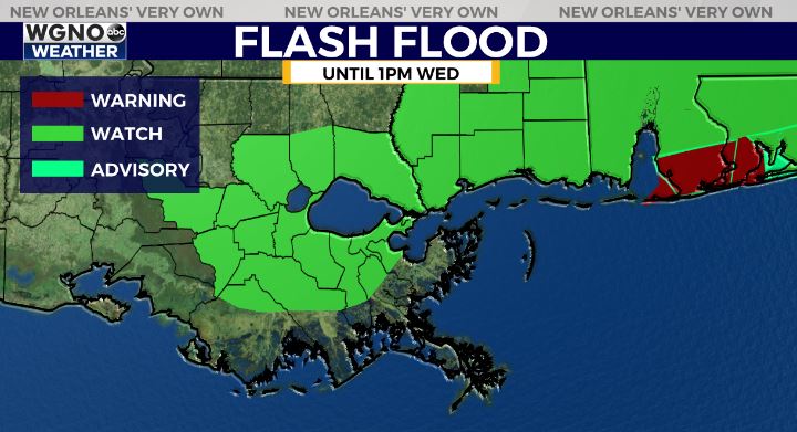
The National Weather Service has extended the Flash Flood Watch for Southeast Louisiana until 1PM on Wednesday.
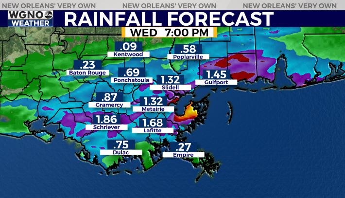
1-3″ of rainfall overnight has led to saturated soils. An additional 1-3″ of rainfall possible, which could lead to street flooding.
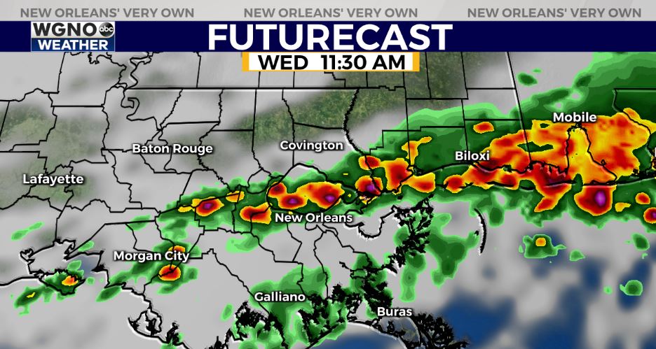
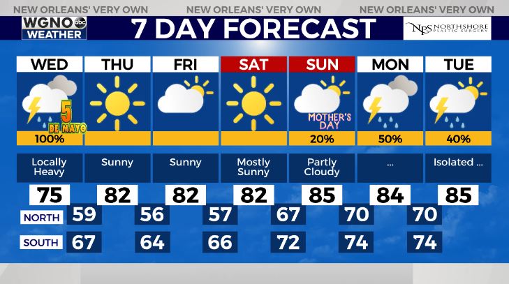
Scatterd locally heavy storms likely this morning into the early afternoon.
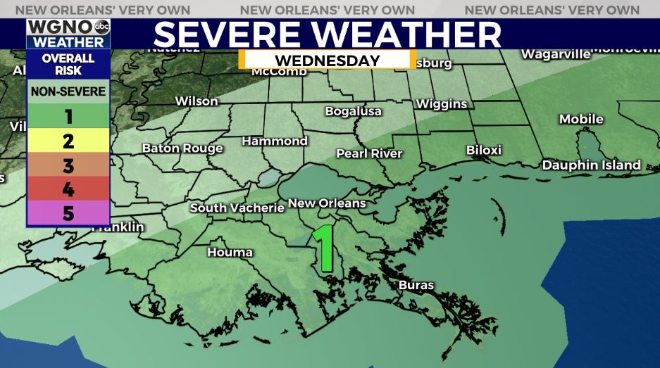
An isolated strong to severe storm possible with gusty winds and lightning as the primary risks along with the heavy rain threat.
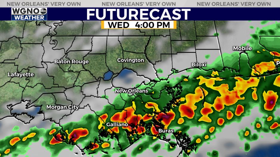
The good news? Rain will begin to clear from north to south into the late afternoon with most parts of the area dry for Cinco De Mayo plans this evening!