It definitely feels like summer out there with dewpoints in the 70s and that trend will continue overnight. Look for lows to only drop into the mid 70s by Tuesday morning.
Tuesday afternoon will be hot as well ahead of a front. Temperatures will likely climb into the upper 80s and some areas could reach 90 with the wind out of the southwest. Breezy conditions tomorrow at 15-20.
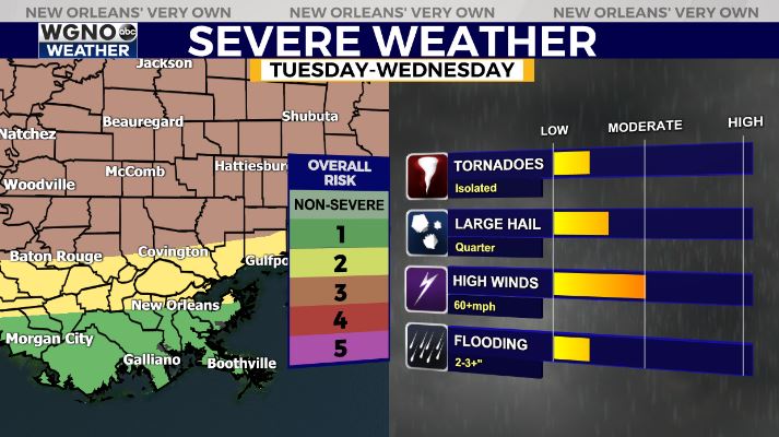
This will lead to a line of storms coming in from the north tomorrow afternoon and evening. This line will likely be strongest just north of the area. However we could still see part of that move in to the northern half with potent wind and hail.
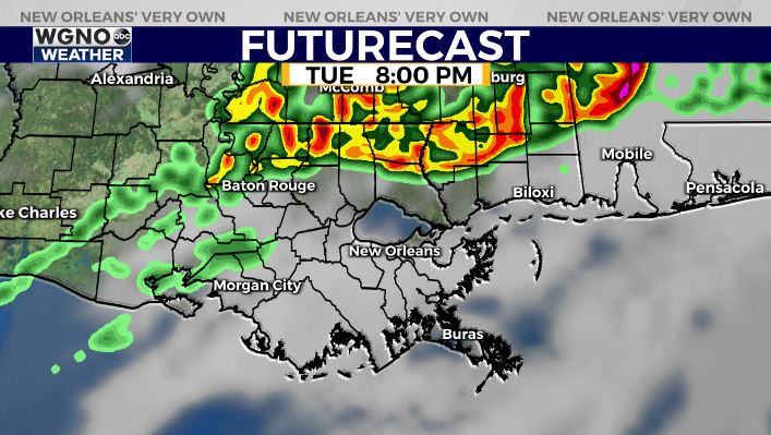
The SPC actually has the level 3 threat for tomorrow afternoon and tomorrow night for areas north of I-12. Severe storms will be possible with strong wind gusts the main threat.
Rain chances will linger with the front Wednesday into early Thursday before the front moves out. After that we will likely get a short break from the humid conditions by the end of the week.
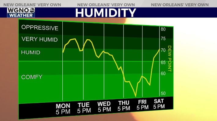
Enjoy that though because it looks like humidity comes back by the end of the weekend for Mother’s Day.


