
7:00AM VIDEO FORECAST — Flash Flood Watch issued for parts of the area. Severe risk this afternoon-evening. Here’s the breakdown:
Through mid day Tuesday, a few spotty showers possible. Rain chance at near 30% coverage, with best rain opportunity on the Northshore.
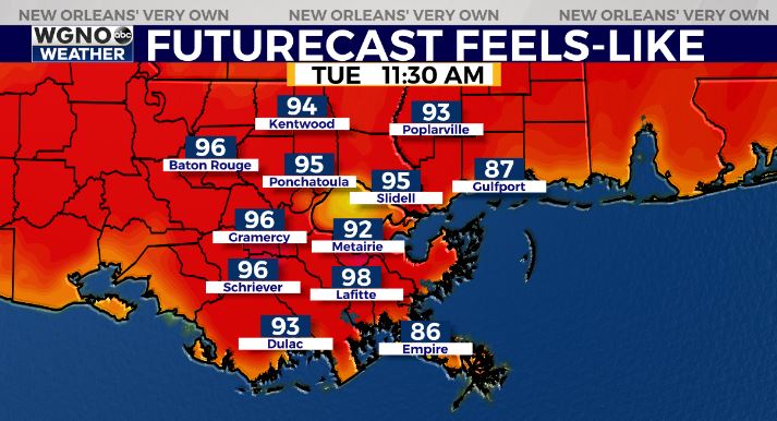
High temperatures in the upper 80s with heat index values in the low-middle 90s.
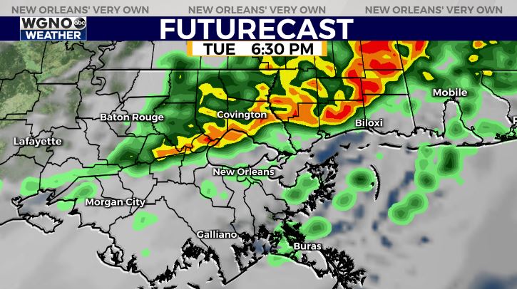
By late Tuesday-early Wednesday, rain chances will climb. Best ingredients for severe weather look to be north of I-12/I-10.
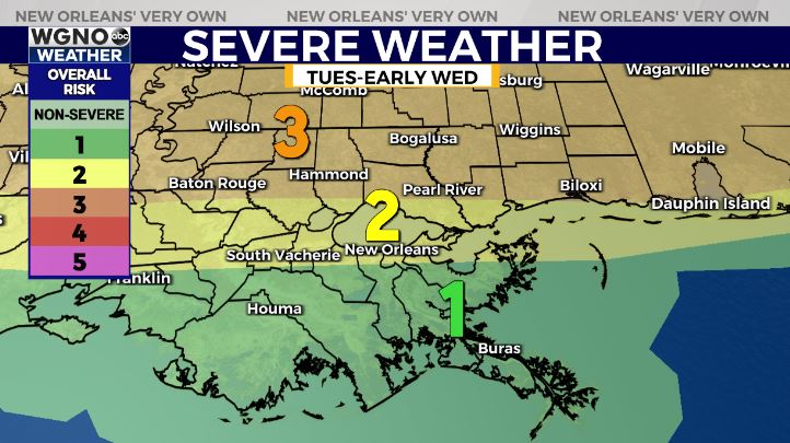
The Storm Prediction Center has much of the Northshore within an Enhanced Risk(Level 3 out of 5) and a Slight Risk(Level 2 out of 5) for severe thunderstorms in Metro New Orleans. Main risk of damaging winds with an isolated tornado/large hail potential.
Across coastal southeast Louisiana, there is a Margianl(Level 1 out of 5) for severe thunderstorms. Main risk of gusty winds, lightning, localized 1-3″ of rain.
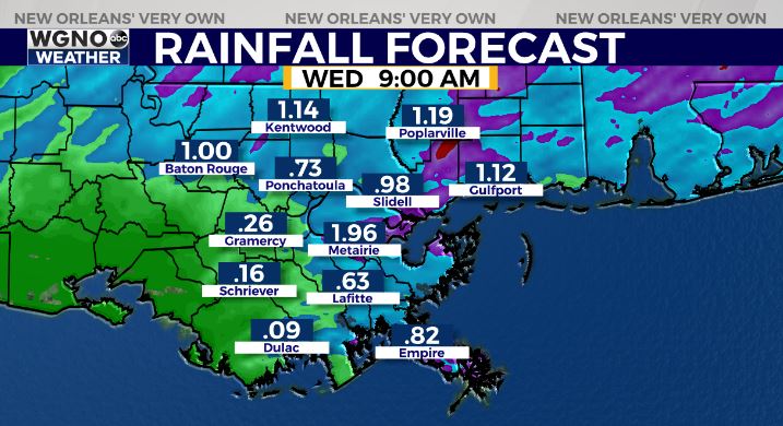
By mid-late Wednesday, rain will clear to the south! Just in time for Cinco De Mayo plans.

This front will help clear the warm, muggy, and stormy weather! A gorgeous late week and early weekend forecast!


