This is an archived article and the information in the article may be outdated. Please look at the time stamp on the story to see when it was last updated.
Temperatures are falling quicker Tuesday night than Monday thanks to less cloud cover heading into the overnight hours. This means a longer time around freezing in the morning but still just a light freeze.
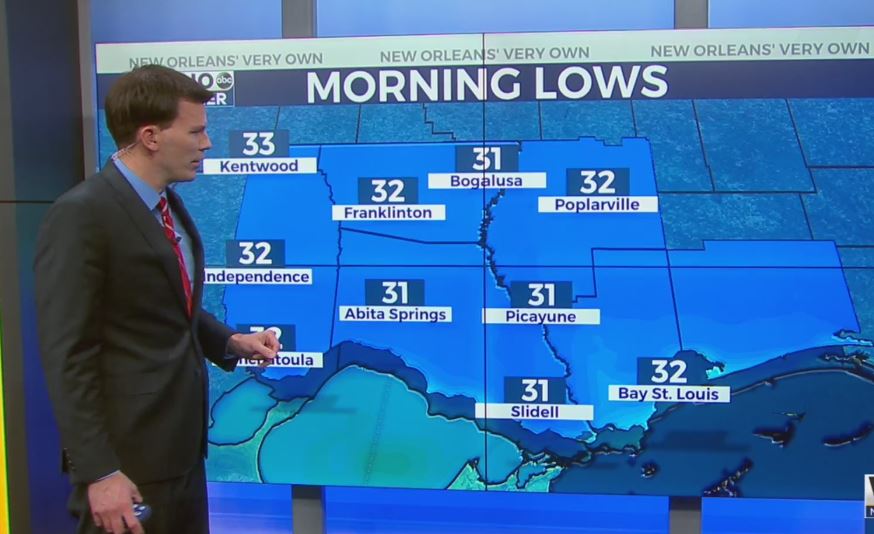
We will see a light freeze once again around 31-32 so cover the plants but the pipes will be fine. Expect mid to upper 30s on the south shore.
After that we will warm quickly heading into Wednesday afternoon. Look for mid 60s for much of the area with plenty of sun.
The warming trend will continue through the week with mid to upper 60s by Thursday. We will stay pleasant through Saturday until a cold front brings another shot of cold air on Sunday.


