Overcast skies and rainy conditions continue through the evening with temperatures remaining fairly steady in the mid to upper 40s.
Widespread showers and possibly a few thunderstorms are expected to continue pushing in from the west through Monday night into Tuesday morning. Models show the rain initially moving in between 4 PM and 6 PM, with coverage increasing into the late evening hours.
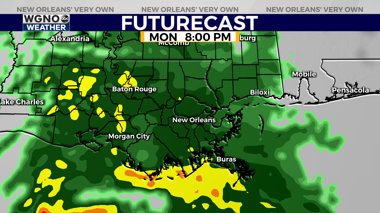
The low pressure system associated with this rainmaker will stay offshore which will keep the heaviest rain and stronger thunderstorm activity to our south. The risk for severe weather is very low.
We will see see areas of heavier downpours though mix in to the larger batch in the late evening hours, mainly between 7 PM and 10 PM.
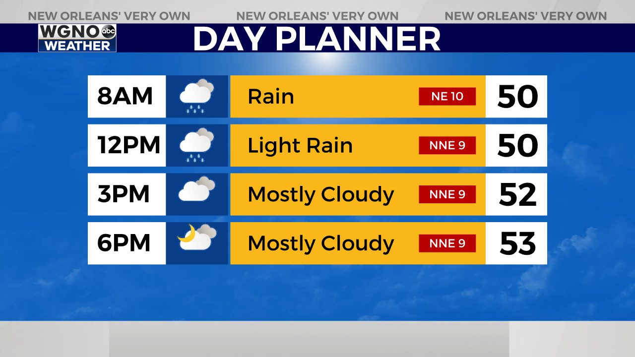
This rain will continue into tonight and then turn into scattered showers by daybreak Tuesday. We will dry out by late Tuesday morning and then just stay seasonably cool through the rest of the week. Look for lows to drop back below freezing by Thursday morning for areas north and west of Lake Pontchartrain.


