Another chilly night is on the way before we start to see warmer temperatures move in over the next couple of days.
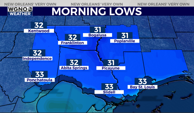
Look for clear skies and light wind to allow temperatures to drop quickly after sunset. Lows will be in the low 30s in the northern areas.

This won’t be a significant freeze but still, you will want to protect sensitive plants.
Look for the mid to upper 30s and low 40s south.
Tuesday should be a beautiful day. We will see plenty of sun with the mid-60s for highs. After that, we warm up even more on Wednesday to the low to mid-70s.
The next cold front comes in later Wednesday night and Thursday morning.
Expect showers and a few storms as that moves through.
After that, we cool back down quite a bit for the end of the week. Thursday will only be in the mid-50s while Friday likely only tops out in the mid-40s.


