Happy Monday! Low rain chances, unseasonal heat, and clouds are back once again in your forecast for today to Tuesday. We have summer-like conditions Monday and Tuesday, Spring Wednesday, and fall Thursday until Halloween.
Overnight, over Northshore locations, 50s will be the theme with 60s south! A weak cold front is bringing humidity down by tomorrow ahead of a much more potent one on its way mid-week.
Wednesday, we see an upcoming pattern change with one more real cold front moving through, bringing fall back again in southeast Louisiana. At that point, heavy downpours could lead to possible street flood advisories, so have a way you can receive warning information on hand. This is also likely posing widespread severe threats with damaging winds, hail, and isolated tornadoes possible.
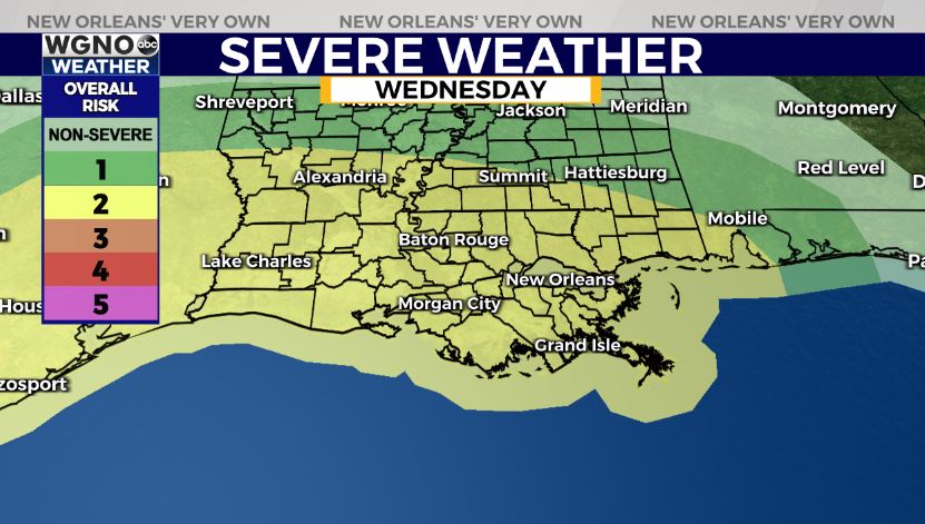
Right now, the Storm Prediction Center is issuing a level 2/5 (Slight Risk) of severe thunderstorms moving through our area Wednesday afternoon into Wednesday evening. Be intentional in staying weather aware and having ways you can receive warning information on hand.
Once this front passes through, our forecast for Thursday will be windy as temperatures fall into the 70s and 60s for highs. A seasonal forecast for Halloween will be return with sunshine and chilly overnight lows.
We’ll have more information on WGNO News at 5PM, 6PM, and 10PM.


