
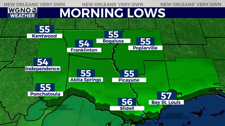
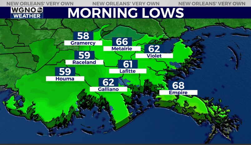
The cold front is south of the area and we are seeing the dry air moving in behind it Wednesday morning. Dewpoints are already down into the low 60s in the northern spots.
Dry air will continue to move in through the day with those numbers in the low to mid 50s by the afternoon. Skies will be clearing through the day as well with plenty of sun by later this afternoon. Winds will be breezy out of the northwest at 10-15mph through the day. This will be the start of some tremendous weather over the next few days.
Look for upper 70s to around 80 over the next few days for afternoon highs. Overnight lows will cool into the mid 50s to the north with upper 50s to low 60s south through Friday.
Temperatures start to warm over the weekend but humidity stays low and at this point there is no rain chance through at least Monday.


