Invest 99L continues to show signs of better organization Thursday morning and the National Hurricane Center now has the chance of development at 90% over the next couple of days. A depression could form by later today or tonight. They have shifted the zone of development a bit northeast and more over Cuba this morning.
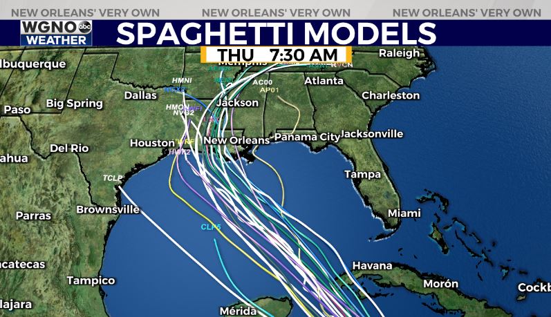
This system lifted north yesterday evening which means the track is looking more likely that it comes to Louisiana as opposed to Texas. This system will likely pass between the Yucatan and Cuba. On that track storms typically end up more along the Louisiana coast.
The group of models is also coming into agreement about a Louisiana landfall.
At the end of the day there are still a lot of questions on this regarding future track and intensity. Conditions do seem favorable for strengthening in the Gulf and we could see significant strengthening from this through the weekend.
At this point it’s still early to tell what and how much we could see. But you do need to be prepared for a storm that produces tropical conditions by Sunday. As always we will follow this closely over the next few days.


