The forecast for New Orleans and southeast Louisiana was hot all day today with more rain in the area keeping temperatures as well as feels like temperatures cooler in the metro than yesterday.
Highs, themselves, reached 90s again but felt more like 100s at times. Overnight, over both sides of Lake Pontchartrain, expect 70s.
Into your week’s start, there’s the chance we see additional scattered downpours! 50% or 60% chances remain the theme. Tomorrow, showers for brief relief are a little more widespread as more than half of the area can expect rain. All week, most rain chances remain daytime heating driven throughout the hottest part of your day.
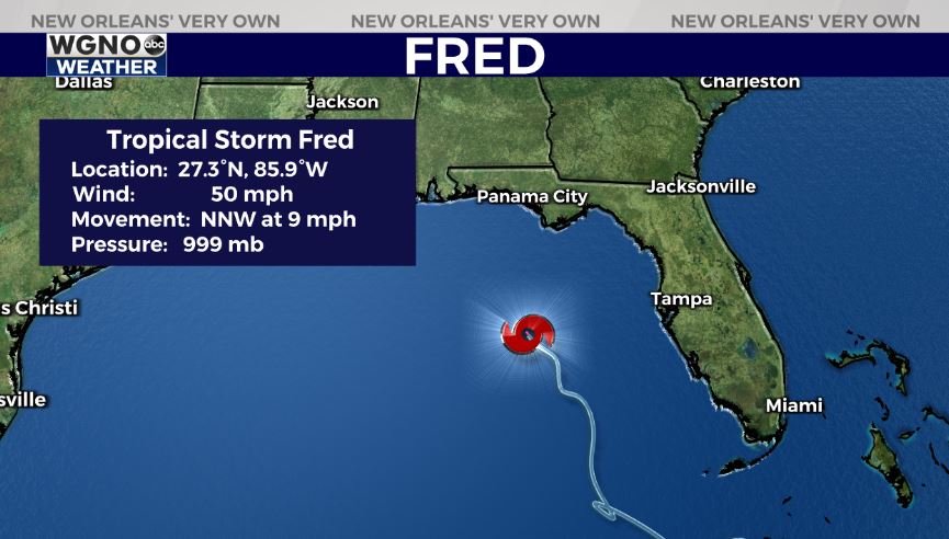
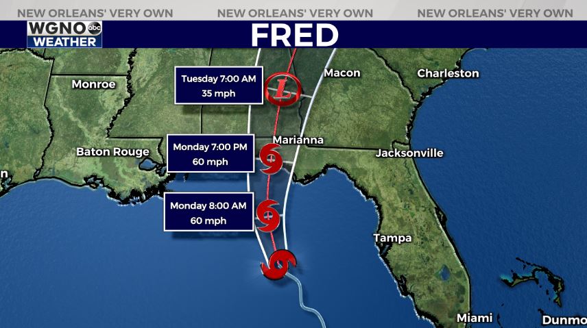
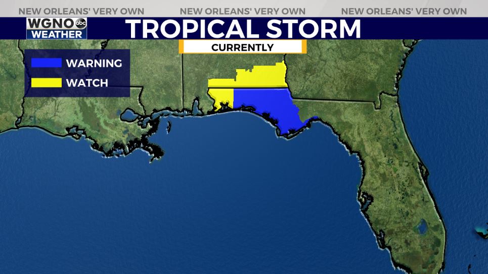
Fred is now once again a tropical storm. The system will move north before making landfall between Destin and Panama City on Monday. All of the Mississippi Gulf Coast and Louisiana Gulf Coast are now no longer included in the cone as impacts will remain east.
Windspeeds will likely be between 50 miles per hour and 60+ miles per hour, but there’s the small chance rapid intensification in the 24 hours before landfall could occur. Windspeeds much reach 74 miles per hour to be classified as a category one hurricane.
The system’s center reorganized early Sunday morning. The overall speed will likely slow down before landfall to create potential rainfall flooding issues along and east of wherever Fred’s center tracks onshore before moving inland. Storm surge will not be a huge issue with these beach towns built up so high above the waterfront along Santa Rosa County’s shoreline. Tropical Storm warnings are now flying across the Florida Panhandle. Remember, this is what happens 48 hours before tropical storm conditions are possible.
Tropical Depression Grace is behind Fred with a similar forecast for intensity. In the beginning, Fred’s path looked just like Grace’s right now. Over the past couple of days, Grace’s path has shifted considerably west and south. We are watching this system very closely for potential track shifts, but right now, Louisiana’s coastline is no longer included in the cone on this storm’s eastern side. The path will continue to change as this storm will not be near our state until late next week.
Join in for forecast updates and the latest track information on Good Morning New Orleans Monday.


