
The latest update from the National Hurricane Center Thursday morning says Fred is closer to an open wave than an actual tropical depression. However they kept it at 35mph and depression status during the 10AM update.
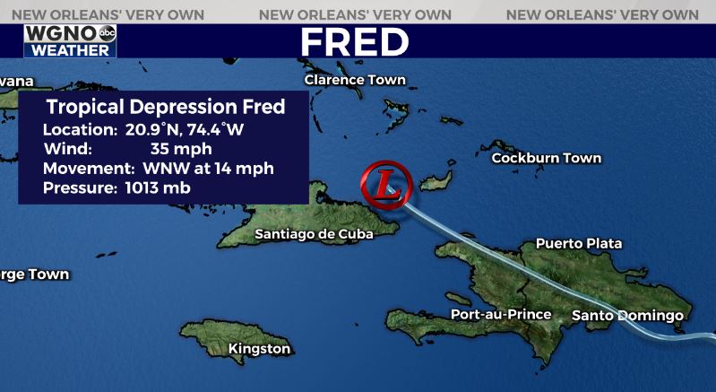
Fred still has a visible circulation but just about all of the thunderstorms and rain associated with the system are well away from the center. It will struggle to maintain it’s intensity over the next couple of days thanks to wind shear.
Fred will likely pass along the northern edge of Cuba and into the eastern Gulf. At that point we will be watching to see how far off the Florida peninsula it moves. If it stays farther west over the open water it could still have a chance to strengthen quite a bit before landfall.
All indications right now continue to point to a landfall along the Florida panhandle with no impacts to our area locally.


