The forecast for New Orleans and southeast Louisiana is cooler with scattered rain in the area keeping temperatures as well as feels like temperatures below average.
These heavy downpours, thankfully, provide temporary relief from extreme afternoon heat at times. Afternoon highs, themselves, reached low 90s again but felt more like 100s. Overnight, over both sides of Lake Pontchartrain, expect 70s.
Thursday into your weekend, there’s the chance we see additional scattered rain chances! 60% or 70% chances remain the theme. Tomorrow, showers for brief relief are a little more widespread as more than half of the area can expect rain. This week, most rain chances remain daytime heating driven throughout the hottest part of your day.
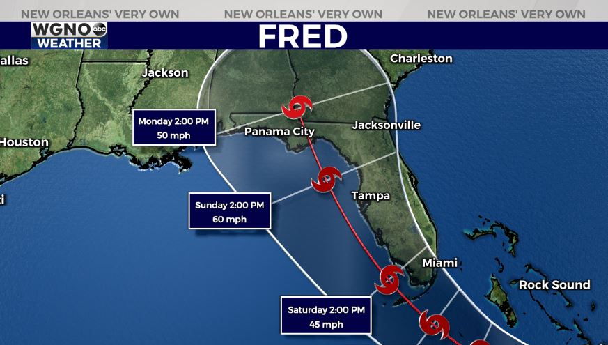
Tropical Storm Fred is weakening in intensity while tracking over Hispaniola, before heading west for our United States coastline. All models continue bringing this system up the East Coast at that same tropical storm intensity with heaviest impacts along and east of where its center moves onshore. More than likely, this is going to be between Florida’s Panhandle and Florida’s Big Bend. Right now, no local concerns but we are watching closely.
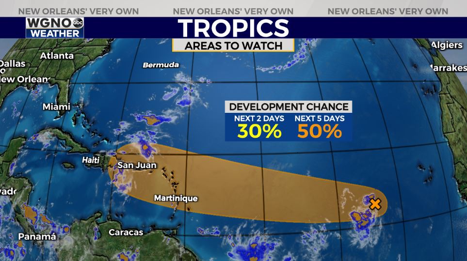
Behind this is yet another tropical wave off of Africa’s coast with medium development potential. Right now, the system has a 30% chances of development over the next two days and 50% chances over the next five. The next name on the list is Grace as peak hurricane season continues.
Stay tuned as more information in WGNO.com articles plus each newscast will be available during WGNO News at 6PM and 10PM.


