It has been a very active Monday to our west as heavy rain in portions of Louisiana has resulted in extreme flash flooding throughout Lake Charles. Here, locally, on and off showers are the theme, but heavier rain will continue pushing east this afternoon to tonight.
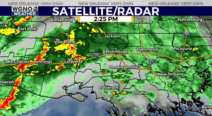
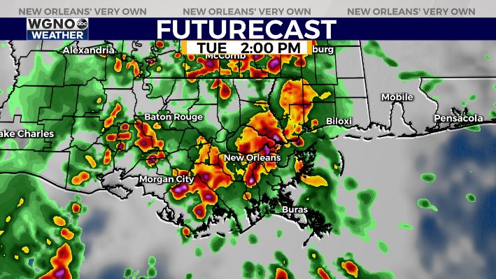
Right now, there is no Flash Flood Watch in effect for our area, but heavy downpours will stick around for much of the week. Expect a similar pattern Tuesday.
Afternoon highs were, area-wide, reaching the upper 70s to low 80s. Overnight, over both Northshore and Southshore locations, expect similar conditions to last night. 60s on the Northshore but 60s-70s on the Southshore!
Through our upcoming weekend, we continue to see increasing humidity and rain chances. Right now, the Storm Prediction Center is issuing no risk levels here locally for severe potential.
Regardless, since the stormier weather sticks around through next weekend, have ways you can receive warning information on hand incase anything is issued!
Grab that rain gear before heading out and keep up as more information on WGNO.com will be available online on WGNO.com and tonight during WGNO News at 5PM, 6PM, and 10PM!


