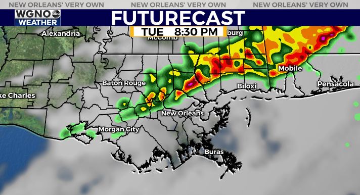
These storms will produce very heavy rain and frequent lightning. There is also the threat of strong wind gusts. Even if there are no warnings issued, winds could still gust into the 30s and 40s creating minor damage.
The bulk of the heavy storms stays to the north through the evening. Some showers and a few storms will be possible on the south shore overnight but these should not be as strong. The heaviest activity will continue moving east through southern Mississippi.
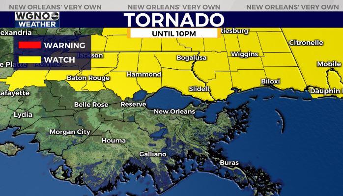
A tornado watch remains in effect for northern areas until 10 PM Tuesday. However the overall severe risk will go down quite a bit behind the initial line of storms.
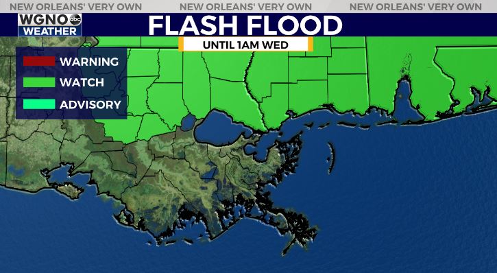
A Flash Flood Watch is also in effect due to the slow moving nature of this line. 1-2 inches of rain will be possible in a short amount of time which could lead to isolated street flooding.
Rain chances will shift south on Wednesday but activity will not be as strong. Look for scattered showers and storms south of I-10 through the day, and then along the coast and offshore Thursday.
Lower humidity will also move in through the rest of the week starting later Wednesday.


