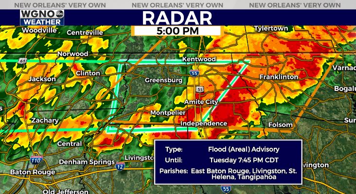
Yet another busy afternoon on radar to our north as a severe weather threat presents itself across much of the south.
For portions of Louisiana, Mississippi, plus Alabama, a Tornado Watch is issued through 6PM.
For portions of Louisiana, Mississippi, Alabama, plus Florida, a Flash Flood Watch is issued until 1AM Wednesday based off of heavy rain threats, which could overwhelm drainage systems.

All of this is primarily Northshore concentrated. Areal Flood Advisory is issued for Livingston, St. Helena, and Tangipahoa Parishes until 7:45PM. Right now, the Storm Prediction Center is issuing higher level risks throughout Mississippi than Louisiana.
Timing will be between now through evening, so have ways to receive warning information on hand incase anything else is issued! Know the difference between each, too!
Keep up, updates will remain available online on WGNO.com and tonight during WGNO News at 5PM, 6PM, and 10PM!
Check out current conditions near you: https://digital-stage.wgno.com/weather/new-orleans-weather-radar/
Stay up to date with the latest forecast: digital-stage.wgno.com/weather/forecast/
Download the WGNO Weather App to stay connected this hurricane season


