After a very active start to today across WGNO’s viewing area, storms have temporarily ended here, locally but will ramp up again in some areas shortly.
Keep your umbrella close as on and off showers could still be the theme by evening.
Anticipate an overall pleasant night tonight, with 60s-70s north of Lake Pontchartrain and low 70s south!
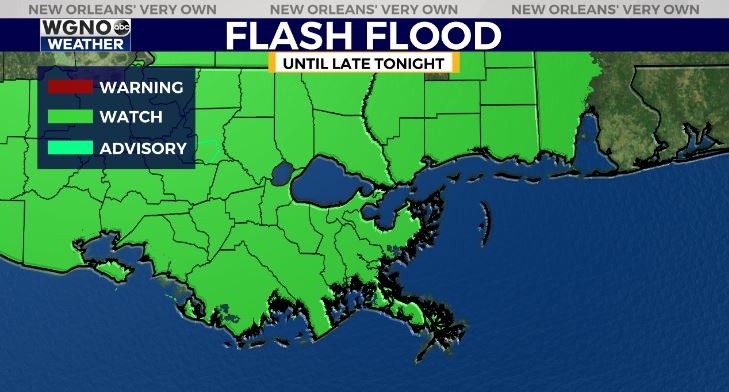
Flash Flood Watch is cancelled early as 1-3 inches in rainfall will likely accompany more Central Louisiana thunderstorms heading east.
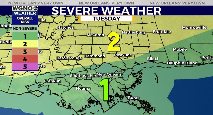
Anticipate an increase in rain chances through early tonight, especially south near coastal locations. Right now, the Storm Prediction Center is issuing a Slight Risk (Level 2 out of 5) north, Marginal Risk (Level 1 out of 5) south.

Aside from any potential flash flooding, gusty winds and hail potential are the primary concerns with an isolated tornado risk being tough to rule out entirely once more late Tuesday.
Have ways to receive warning information in case a severe thunderstorm or tornado organizes again. Keep up, updates remain avaialable online on WGNO.com and tomorrow during WGNO News at 10PM!
Check out current conditions near you: https://digital-stage.wgno.com/weather/new-orleans-weather-radar/
Stay up to date with the latest forecast: digital-stage.wgno.com/weather/forecast/
Download the WGNO Weather App to stay connected this hurricane season


