11:30AM VIDEO FORECAST from Meteorologist Scot Pilie — Gorgeous, warm Monday. Heavy rain & severe risk Tuesday-Wednesday. Here’s the details:
Heads up! Mother Nature is taking the phrase April Showers bring May Flowers way too seriously this year.

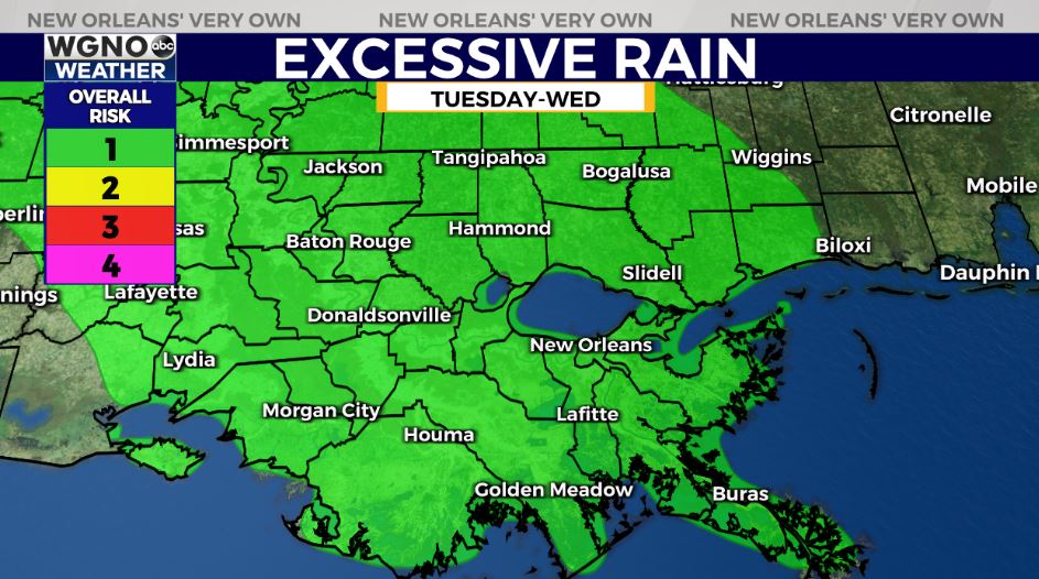
After a quiet & lovely Monday, we’re monitoring another threat for flash flooding & severe weather Tuesday and into Wednesday, with rain potentially continuing into Thursday.
Stalled frontal boundary will provide sufficient lift for thunderstorm development starting Tuesday morning-mid day. More widespread thunderstorm development into the afternoon into the late evening.
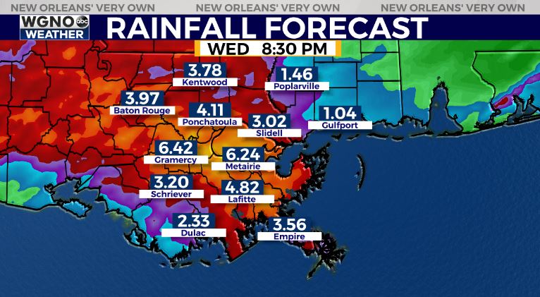
Localized heavy rainfall of 2-4″ appears likely, with localized hot spots of 3-6+” possible between Tuesday-Wednesday.
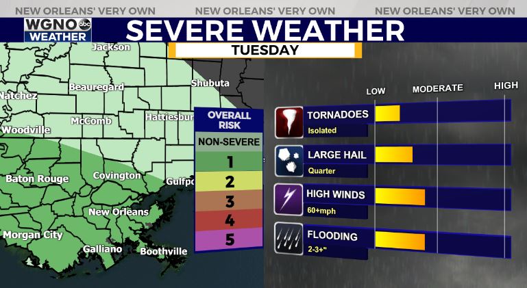
Main severe risks of gusty winds & large hail, with low end tornado risk.


