Overall, this is a gorgeous forecast for the last day of your weekend across southeast Louisiana and New Orleans, itself.
Yesterday, we were dealing with additional clouds and cooler highs, too, to make it feel ever colder after severe weather ripped through early. Temperatures are a bit warmer today across the state.
Now, it’s tough to stay inside in these gorgeous conditions with sunshine galore. Highs by your afternoon after lunch are reaching the 80s area-wide. Just a perfect forecast for any outdoor festivies including crawfish boils on Masters Sunday.
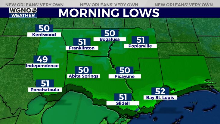
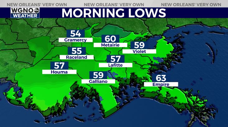
Anticipate an overall pleasant night tonight, as well. It will be a bit more chilly than anything these last few nights with temperatures falling into the 40s-50s north of Lake Ponchartrain and 50s-60s south!
Monday, few clouds return but the theme continues being warmth. We’ll see an increase in rain chances on Tuesday as highs begin climbing beyond 80 degrees once again.
Keep up, updates remain available online on WGNO.com all night tonight and during WGNO News at 10PM!
Check out current conditions near you: https://digital-stage.wgno.com/weather/new-orleans-weather-radar/
Stay up to date with the latest forecast: digital-stage.wgno.com/weather/forecast/
Download the WGNO Weather App to stay connected this hurricane season


