
Temperatures are cooler than yesterday and are mostly in the upper 50s to low 60s across the area. It’s a beautiful day though with the sun and the breeze. Absolutely no humidity to worry about.
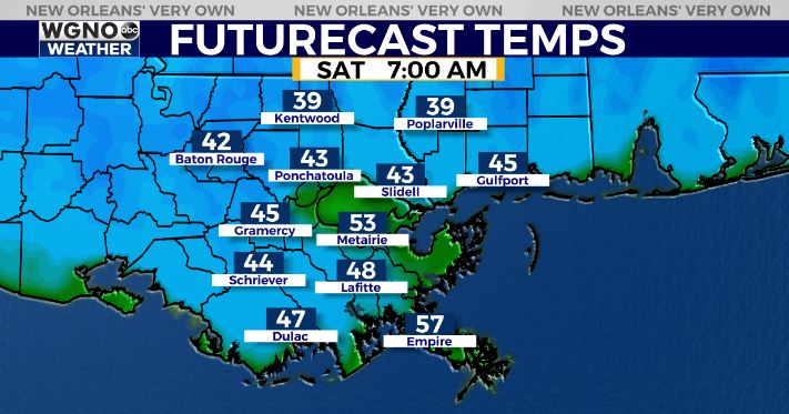
Look for another chilly night on the way with lows Saturday morning dropping into the mid to upper 30s north with mid to upper 40s south.
Tonight should actually see betting conditions for cooling with lighter wind, but as high pressure shifts east that air mass change will begin. However once again patchy frost will be possible in some spots as temperatures briefly drop into the mid 30s.
Otherwise warmer for your Easter weekend. Look for highs around 70 Saturday with low 70s on Sunday.
Check out current conditions near you: https://digital-stage.wgno.com/weather/new-orleans-weather-radar/
Stay up to date with the latest forecast: digital-stage.wgno.com/weather/forecast/
Download the WGNO Weather App to stay connected this hurricane season


