After a cold front moved through yesterday afternoon on radar, it truly was an incredibly gorgeous day today.
Highs, area-wide, reached 70s, but temperatures will be beginning to fall shortly. Anticipate an overall pleasant, cool night tonight in 50s north of Lake Pontchartrain and 60s south.
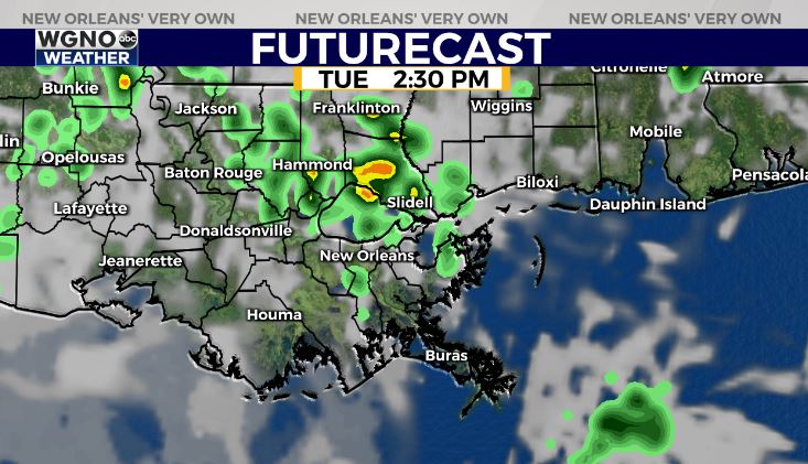
Tomorrow, rain chances increase in your Tuesday outlook with additional warmth. This is because today’s cold front lifts north as a warm front, bringing highs up to upper 70s, low 80s.
Another cold front returns mid-week, so the storms will ramp up again in these next couple of days.
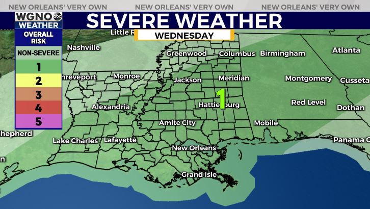
Wednesday, the Storm Prediction Center is issuing a Marginal Risk (level 1 out of 5) for severe thunderstorms. This is a low end threat, but gusty winds and a possible spin up tornado cannot be ruled out completely.
We have spring-like patterns sticking around with the forecast for Easter weekend looking much quieter. At that point, it will feel like it does right now once more.
Keep up, updates remain available online on WGNO.com and during WGNO News at 10!
Check out current conditions near you: https://digital-stage.wgno.com/weather/new-orleans-weather-radar/
Stay up to date with the latest forecast: digital-stage.wgno.com/weather/forecast/
Download the WGNO Weather App to stay connected this hurricane season


