The threat for heavy rain with several inches of additional rainfall continues Tuesday evening across the southern half of the area. The heaviest band of rain has shifted south of I-10 through the afternoon. This is where the biggest concern will stay.
A Flash Flood Warning continues for parts of Lafourche and Terrebonne parishes with a Flood Advisory in effect for the immediate New Orleans metro. Flooding should begin to recede across the New Orleans area as the heaviest rain remains to the south.
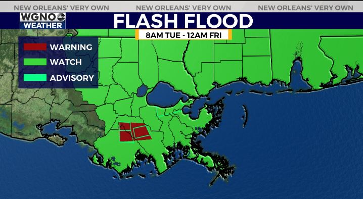
Areas south of I-10 could still pick up several inches tonight and the forecast totals of rain through Thursday still show 5-7 inches possible from extreme southeast Louisiana to the Mississippi coast.
Areas northwest of a Houma to New Orleans to Slidell line will not be seeing as much.
Look for another wave of rain coming in on Wednesday although it will likely be more scattered than what we have seen today. We will have one final chance with the front Thursday afternoon before clearing out some on Friday.
Check out current conditions near you: digital-stage.wgno.com/weather/maps-and-radar/
Stay up to date with the latest forecast: digital-stage.wgno.com/weather/forecast/
Download the WGNO Weather App to stay connected this hurricane season


