4:45AM VIDEO FORECAST from Meteorologist Scot Pilie — St Patrick’s Day severe outbreak expected for parts of the Gulf South. Here’s what to expect:
A rare HIGH RISK(Level 5 out of 5) for severe weather has been placed for NE Louisiana, Central Mississippi, west Alabama.
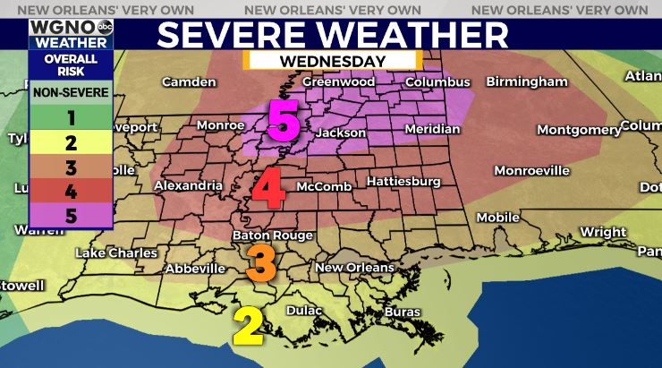
Potential for long-tracked, intense tornadoes, large hail, & damaging winds later today and tonight within the high-risk region.
Please remember, this doesn’t mean everyone will see bad weather, it simply means the ingredients are present for dangerous storms to form somewhere within this region.
If you know anyone that lives in that area, make sure to check in with them to give them the heads up to make sure they have a way to receive weather alerts & to assure they’re staying in a safe structure.
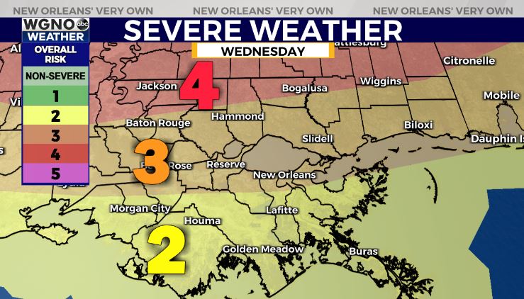
Moderate Risk(Level 4 out of 5) expanded to include areas north of the I-12 corridor. Enhanced Risk(Level 3) expanded to include the I-10 corridor from Lake Charles to New Orleans to Mobile.

All forms of severe weather possible, including damaging winds, hail, & tornadoes.
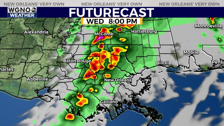
Timing for NOLA Metro — Scattered hit/miss storms mid day into early afternoon with isolated severe storm on the Northshore. Highest rain chances 7PM-midnight.
More on WGNO all morning from 4:30-9AM.


