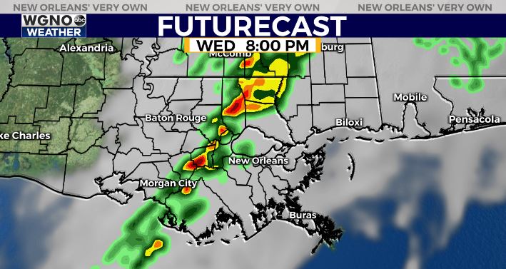
A strong cold front will be moving across the region Wednesday evening and night. Expect warm and windy conditions out ahead of the front with a few spotty showers possible early in the day.
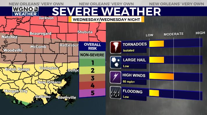
The main line of storms will move through the area after sunset. This line will contain storms that could become severe. Expect locally heavy rain and frequent lightning as well with this line.
While the main threat of severe weather stays farther north, we still need to watch the threat for southeast Louisiana and southern Mississippi. An isolated tornado will be possible along with strong wind gusts and hail.
The line of rain quickly moves east overnight into Thursday morning and we will see cooler and drier air push in through the rest of the week.
Check out current conditions near you: https://digital-stage.wgno.com/weather/new-orleans-weather-radar/
Stay up to date with the latest forecast: digital-stage.wgno.com/weather/forecast/
Download the WGNO Weather App to stay connected this hurricane season


