We are in for another chilly night but not as cold as what we had last night when we saw some mid 30s in the northern spots. Look for mainly low 40s north with mid to upper 40s south by Friday morning.
It is possible though a couple of the cooler spots briefly dip into the 30s. Overall another mild day is ahead for Friday but it will probably feel a little cooler thanks to the cloud cover. Temperatures will warm into the upper 60s to around 70 as clouds increase.
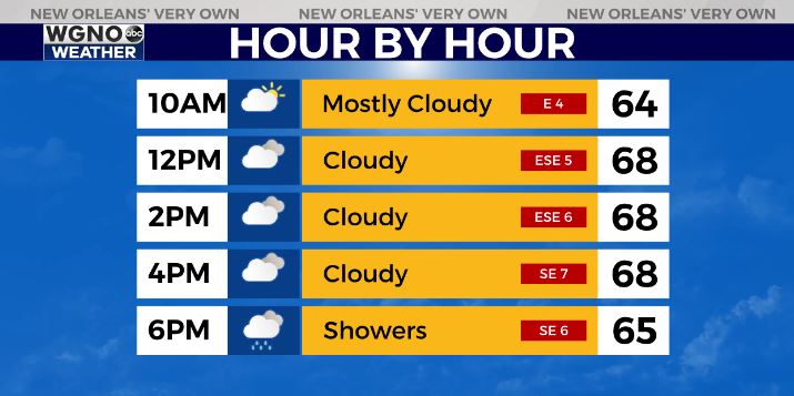
Rain will start to move in to the area by the evening with spotty showers possible by 5-6 PM. Otherwise a good area of rain will move across through the night. Some locally heavier downpours will be possible.
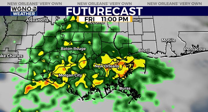
Rain is out of the area by sunrise Saturday and we will see a nice weekend with mid to upper 60s for highs and cool nights.
Check out current conditions near you: https://digital-stage.wgno.com/weather/new-orleans-weather-radar/
Stay up to date with the latest forecast: digital-stage.wgno.com/weather/forecast/
Download the WGNO Weather App to stay connected this hurricane season


