A cold front is on the way later this morning which will bring the sun back to the area through the afternoon. Currently there is only a thin band of showers with the front and rain chances overall are low across the area.
Ahead of the front look for some cloud cover and patchy fog. Fog is showing up already along the I-55 corridor this morning as moisture pools ahead of the front.
Look for a fairly mild afternoon even as the front passes. Temperatures will be in the mid to upper 60s for a beautiful afternoon.
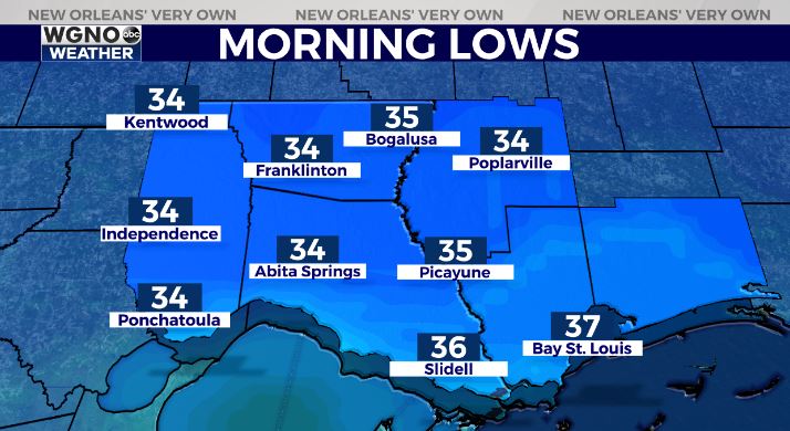
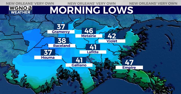
After that we do see a brief shot a cool air overnight. Lows will be in the mid 30s to the north.

Look for some upper 30s to low 40s south.

Otherwise the rest of the week will be mild with upper 60s Tuesday and low to mid 70s after that.
Check out current conditions near you: digital-stage.wgno.com/weather/maps-and-radar/
Stay up to date with the latest forecast: digital-stage.wgno.com/weather/forecast/
Download the WGNO Weather App to stay connected this hurricane season


