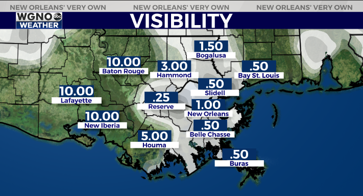
Potentially dangerous fog will be around the area overnight and into Thursday morning. Expect widespread visibilities of under 1/2 mile. Remember to use the low beam headlights.
Fog is already fairly widespread at 10PM and should continue.
We will also see rain spreading into the area later tonight and through Thursday. Some of this rain could be locally heavy at times.
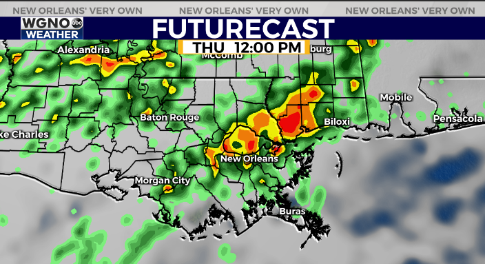
Rain will continue at least off and on through Friday as well before lower rain chances over the weekend.
Thursday will start on the warm side. Look for temperatures near 70 through the morning on the south shore. However the front will move through earlier to the northwestern parts of the area so expect cooler temperatures up I-55 by early afternoon.
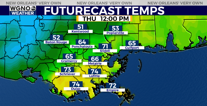
After that we will stay chilly through the middle of next week. More rain moves in on Monday.
Check out current conditions near you: https://digital-stage.wgno.com/weather/new-orleans-weather-radar/
Stay up to date with the latest forecast: digital-stage.wgno.com/weather/forecast/
Download the WGNO Weather App to stay connected this hurricane season


