Warmer and more humid air will be moving back into the area over the next few days starting tonight. This means it will feel a bit more like spring through the middle of the week and also means we could see some fog over the next few nights.
Dewpoints will start to be higher than the temperature of the area waters which means sea fog will start to develop. This will likely be the worst south of I-10 and along the Mississippi coast. Most of this will be patchy but could be more dense at times.
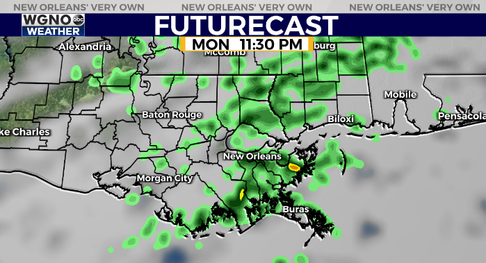
Look for spotty showers around the area Monday evening and Monday night. Most of these will be light.
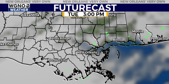
Rain will push out very early Tuesday morning so Tuesday looks dry but cloudy for a good portion of the day. Some late clearing will be possible.
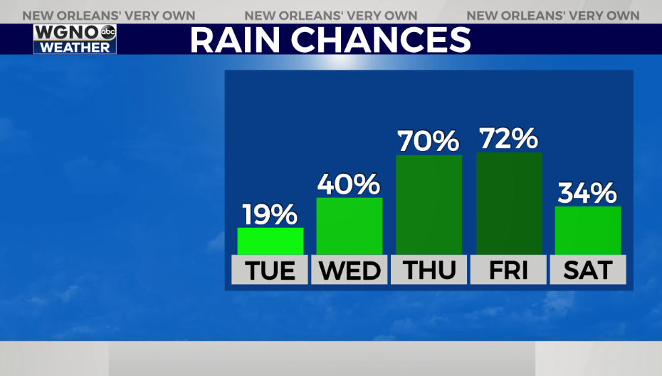
Overall rain chances will continue to increase through the week. Look for scattered showers on Wednesday and then more widespread rain chances Thursday and Friday. It’s possible we could see rain linger into Saturday as well depending on a low developing in the Gulf.
Temperatures will be in the low to mid 70s for highs Wednesday and Thursday but then it does look like we start to cool back down quite a bit by Friday and for the weekend.
Check out current conditions near you: https://digital-stage.wgno.com/weather/new-orleans-weather-radar/
Stay up to date with the latest forecast: digital-stage.wgno.com/weather/forecast/
Download the WGNO Weather App to stay connected this hurricane season


