Scattered showers will continue around the area Tuesday night in to Wednesday morning before a cold front moves through the area.
This evening we are seeing that front draped across southeast Louisiana with spotty showers mainly in the northern half of the area. That trend continues tonight.
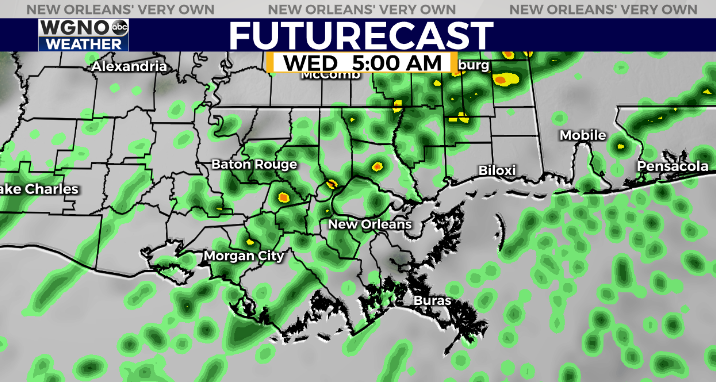
By tomorrow morning the area of rain will sink southward as the front begins to move south as well. Everything should be clearing out by late in the morning Wednesday.
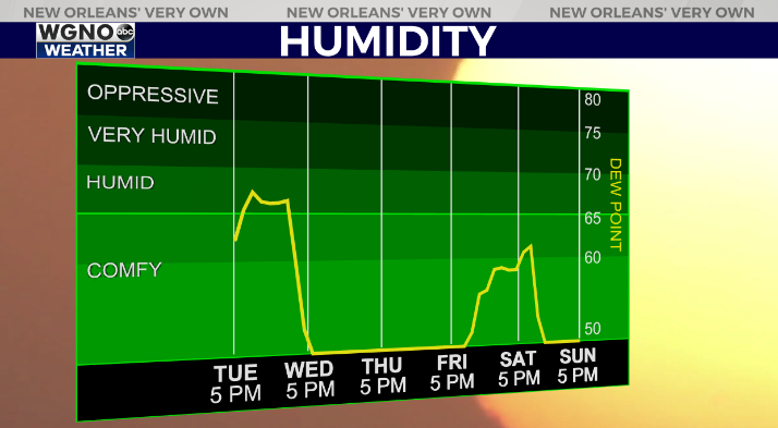
We will see much drier and cooler air move in behind this front for the end of the week. The humidity will be much lower. Also notice over the weekend another front moves in Sunday morning which lowers the humidity again.
Look for highs only in the 50s on Thursday with 30s to the north both Thursday and Friday mornings. Some areas could approach freezing in the colder spots Friday morning.
Another cool show comes in by Monday. Nothing too arctic but cooler than conditions ahead of the front.
Check out current conditions near you: https://digital-stage.wgno.com/weather/new-orleans-weather-radar/
Stay up to date with the latest forecast: digital-stage.wgno.com/weather/forecast/
Download the WGNO Weather App to stay connected this hurricane season


