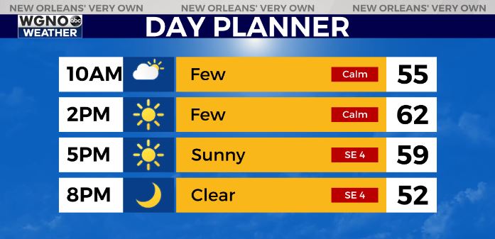
A cold start to the day will give way to seasonable temperatures this afternoon with highs back in the low 60s for most of the area. We will look for plenty of sun with light winds through the day.
One more chilly night is on the way but at this point not as cold as what we have seen over the past few. Look for mid to upper 30s north to low to mid 40s to the south by Tuesday morning.
After that a big warming trend is on the way.
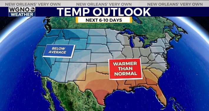
The pattern will be opposite of what is has been for the first half of the month as we go through the next 10 days at least. Warmer than average conditions move into the deep south while the colder temperatures move out west.
This means that afternoon highs will be in the upper 60s to low 70s through the week and overnight lows will mainly be in the 50s.
We will stay dry until at least Friday the way it looks right now when some spotty showers will move in.
Check out current conditions near you: https://digital-stage.wgno.com/weather/new-orleans-weather-radar/
Stay up to date with the latest forecast: digital-stage.wgno.com/weather/forecast/
Download the WGNO Weather App to stay connected this hurricane season


