This is an archived article and the information in the article may be outdated. Please look at the time stamp on the story to see when it was last updated.
11:30AM VIDEO FORECAST from Meteorologist Scot Pilié — Bundle up! Our cold weather pattern continues.
Cloudy conditions to kick off your Tuesday. The good news? We will see breaks of sun by the early afternoon across the area!
It won’t amount to much of anything, but I figured I would mention it! Another slim shot for a few sleet pellets & light rain showers in southeast Louisiana/south Mississippi late Tuesday-early Wednesday. Maybe a flurry or two north of I-12? No impacts expected!
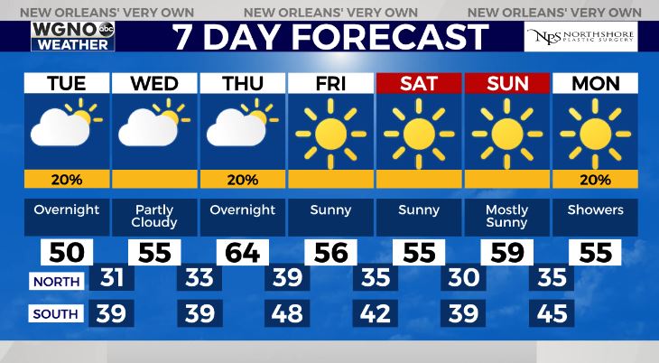
Brief warm up Thursday with high temperatures near 62-65. Our next cold front arrives Thursday night, which will drop our high temperatures back into the 50s Friday through the weekend.


