It has been another stunning day today across the Greater New Orleans area. Sunshine will remain the theme until mid-week, plus warming trends!
We have yet another low pressure system making its way to town by late Wednesday. At that point, shower chances will return primarily overnight alongside a front bring highs from 70s into 60s.
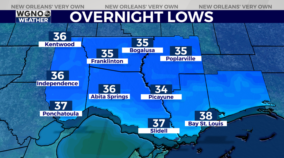
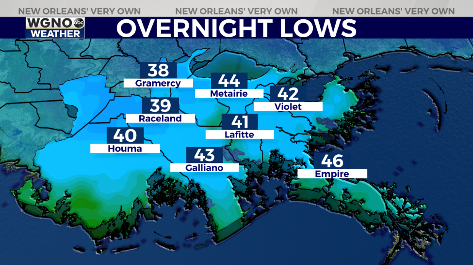
Tonight, anticipate an incredibly chilly one on both sides of Lake Pontchartrain. In many spots, lows will near 32 degrees, so protecting your pets and plants will be best as frost looks possible across Northshore locations.
Think layers before stepping outside because our warm forecast for tomorrow afternoon after lunch remains near 66!
Keep up, updates stay available during WGNO’s upcoming 10 P.M. newscast plus online on WGNO.com!
Check out current conditions near you: https://digital-stage.wgno.com/weather/new-orleans-weather-radar/
Stay up to date with the latest forecast: digital-stage.wgno.com/weather/forecast/
Download the WGNO Weather App to stay connected this hurricane season


