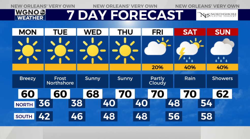
What a cozy, gloomy day today across southeast Louisiana and New Orleans! This is not what you can expect again in these next 24 hours. Sunshine remains the theme ahead. One word that sums up upcoming weather patterns until next week: LAYERS!
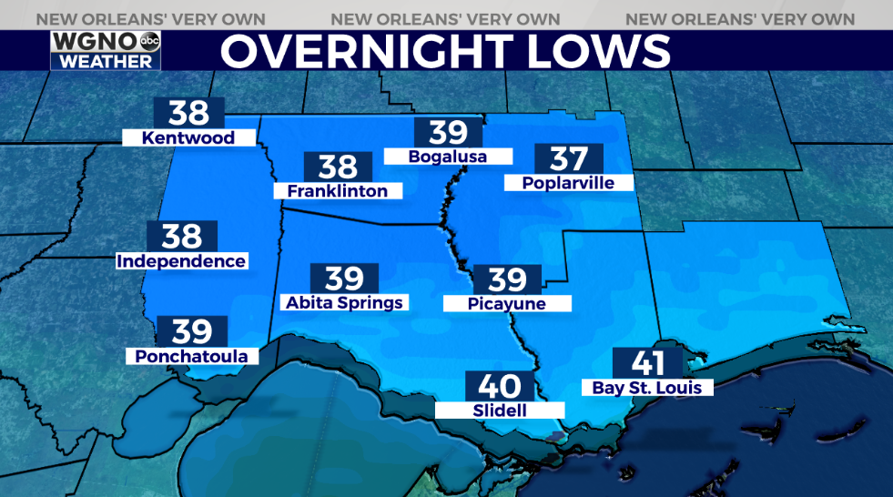
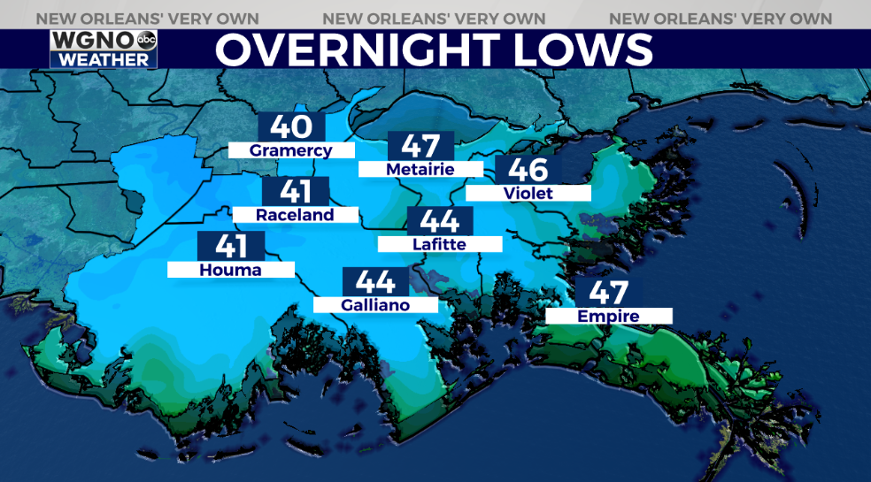
Northshore residents wake up tomorrow to upper 30s – lower 40s outside their windows while Southshore residents can expect upper 40s! This is coat weather. Highs may not even reach 60 degrees tomorrow afternoon after lunch.
Patchy fog may be becoming an issue once more during the early hours, primarily north of I-10. Remember, at that point, low beams are your friend! Exercise caution on the roads if up early!
As a second system arrives next weekend, we see precipitation chances go up greatly. More than likely, temperatures will differ considerably at that point. This is going to allow for forecast conditions by next week to be beautiful once more.
Keep up, updates will be accessible online on WGNO.com and through our WGNO Weather App!
Check out current conditions near you: https://digital-stage.wgno.com/weather/new-orleans-weather-radar/
Stay up to date with the latest forecast: digital-stage.wgno.com/weather/forecast/
Download the WGNO Weather App to stay connected this hurricane season


