—
1200 PM
Showers and storms continue to move slowly across the area. The line will be drifting southeast through the day with locally heavy rain and a low end severe weather threat.
Fog will be possible tonight and tomorrow morning.
—
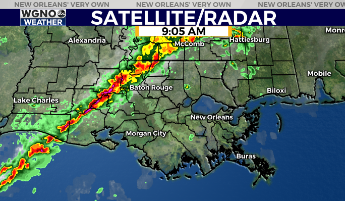
9:00 AM
The line of storms is quickly working to the east and will be moving in by late morning and through the afternoon. There remains a low end threat of severe weather in terms of strong wind gusts and an isolated tornado.
—
A line of rain and storms is moving across Louisiana and Mississippi Wednesday morning and will be the first chance of significant rain we have seen in quite some time.
This line as a history of producing severe weather over the past 24 hours and we will have a chance for that in our area as well.
Look for a threat of strong wind gusts and an isolated tornado as storms move through, especially along and north of I-12.
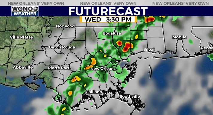
The forecast model shows the line working across the area through the afternoon with a line of showers and embedded storms. The front doesn’t totally clear the area so along and ahead of it tonight we will have the chance for dense fog.
Look for spotty showers to develop Thursday afternoon and again later Friday. The weekend looks a bit wet with the highest rain chance coming Saturday night into Sunday morning.
Temperatures stay mild through Sunday but then cool down big time by early next week.
Have a way to get warnings if they are issued for your area today, and if you are traveling check the radar before heading out.
Check out current conditions near you: https://digital-stage.wgno.com/weather/new-orleans-weather-radar/
Stay up to date with the latest forecast: digital-stage.wgno.com/weather/forecast/
Download the WGNO Weather App to stay connected this hurricane season


