A great week of fall weather is ahead thanks to the cold front that moved through the area Sunday evening. We will see some chilly night and mild days to start the week and then a general warming trend by the weekend.
The air is very dry and that will let temperatures cool down over the next couple of nights and feel fantastic during the day. Look for upper 60s close to 70 through the day today.
Tonight we could see some upper 30s again in the coldest areas with mainly low 40s north and low 50s south.
Highs will be in the low 70s tomorrow through Thursday and then start to warm some over the weekend.
No rain chance anytime soon so it will be dry over the next few days. Keep that in mind if you plan on any outdoor burning.
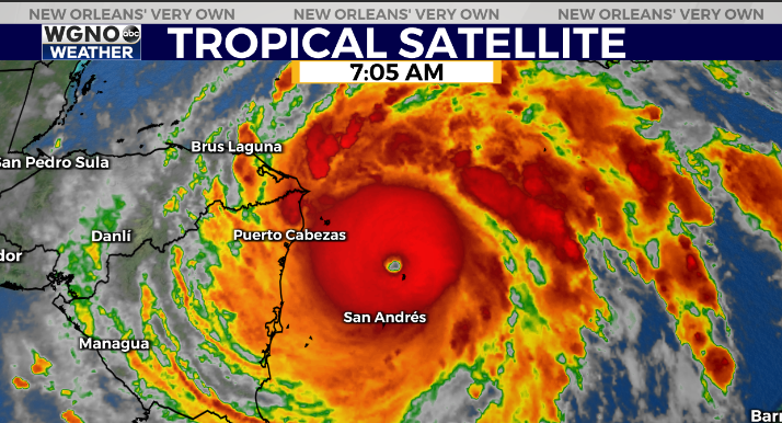
In the tropics Iota has intensified overnight to a category 4 storm with winds of 155 mph. This is now the strongest storm of the season and will stay well to the south as it moves across central America.
Check out current conditions near you: https://digital-stage.wgno.com/weather/new-orleans-weather-radar/
Stay up to date with the latest forecast: digital-stage.wgno.com/weather/forecast/
Download the WGNO Weather App to stay connected this hurricane season


