10:30 PM
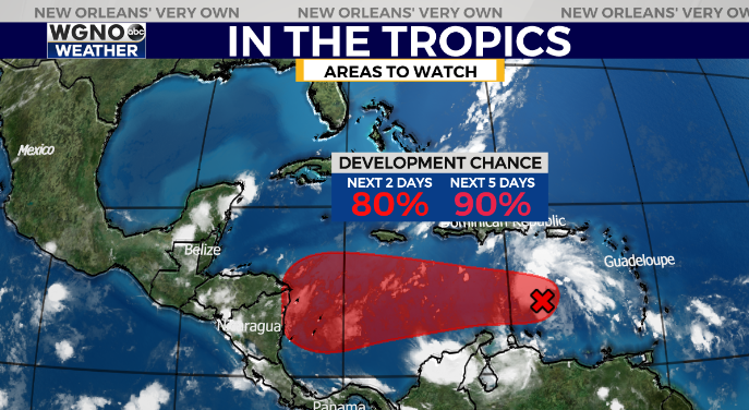
The area in the Caribbean is now up to a 90% chance of development from the Hurricane Center.

This will likely be a tropical depression or named storm over the weekend. Right now most indications are this would go west in Central America however until it is inland it is worth keeping an eye on. This will be in an area similar to where Zeta was when it developed.
Otherwise temperatures are dropping quickly and a cool night is on the way. Beautiful weather will continue over the weekend.
—
6:00 PM
Great weather is on tap through the Halloween weekend. Expect a chilly morning to start the day with lows in the mid 40s. By the afternoon we will see temperatures warming through the upper 60s topping out right around 70.
Tomorrow evening most of the area will be in the mid 60s as the trick or treating begins. Expect low to mid 60s by 8-9 PM.
Dry weather and low humidity will continue over the next week. A cold front moves in late Sunday to bring cool weather back to the area. We will see low 70s Sunday afternoon but only mid 60s for Monday with lows back in the 40s early next week.
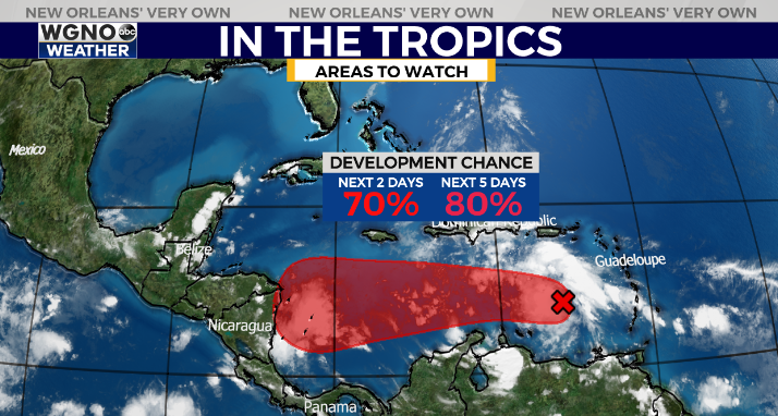
In the tropics we are watching another wave moving into the Caribbean with a high chance of development.

Right now the National Hurricane Center has a very high chance of development on this at 80% over the next 5 days. It’s likely this will become Eta at some point which would tie this season with 2005 with the most named storms on record (the last storm in 2005 was classified later and not given an actual name).
There are no indications right now this would be moving our direction, but it is an area similar to where Zeta formed so we will definitely be watching very closely over the next week.


