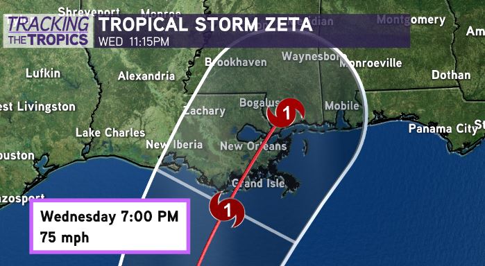
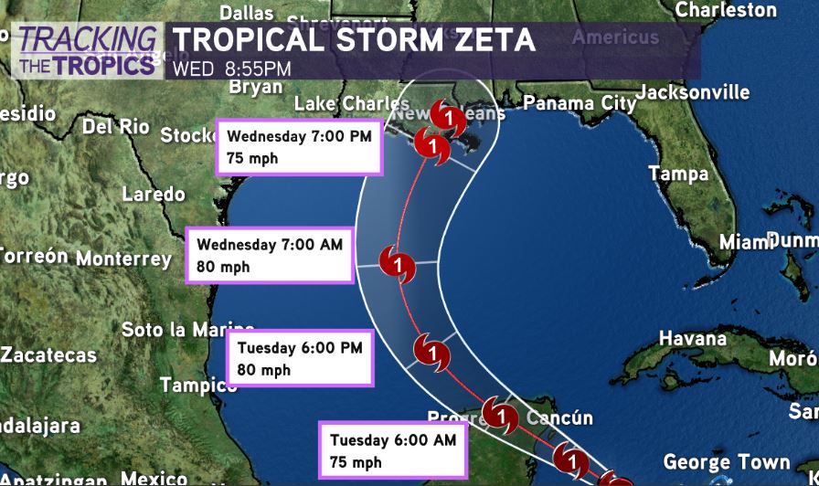
10AM Update from the NHC has Tropical Storm #ZETA near hurricane strength. Intensification has leveled off for now, as system still battling slight northwest wind shear and dry air. Max winds 70mph.

Little change in track, maybe a tad shift west with landfall in southeast Louisiana Wednesday evening. Overall thinking remains unchanged.
Hurricane Watches likely to get issued later today for parts of Louisiana & the northern Gulf Coast, with potential landfall anywhere from Louisiana to the Florida Panhandle late Wednesday-Wednesday night.
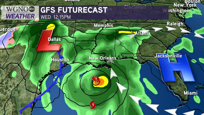
Fortunately, this system will be moving fast & likely weakening slightly as it moves north.
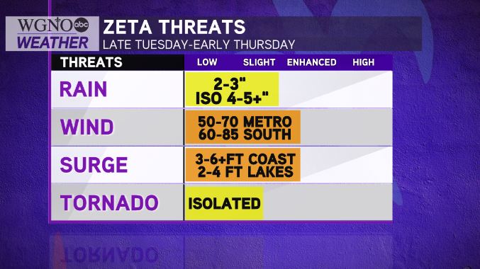
However, it will bring sizeable impacts. Tropical storm or even hurricane wind conditions/localized 2-5″ rain/coastal flooding & storm surge along and east of where center comes ashore.
The key? Wind shear & slightly cooler water temps in the northern Gulf look to be inhibitors to intensification as the system moves northward into the north Gulf. Right now, most guidance weakens the system to a strong tropical storm or minimal hurricane intensity as it nears the northern Gulf Coast.
Timing of an approaching cold front & strength of the system will dictate path of the system. Faster front = more northeast path towards eastern Gulf Coast in AL/FL Panhandle. Slower front = southeast LA/Southern MS.
Remember, in this situation, 50 miles will make a huge difference for SE Louisiana. If it goes 50 miles East, our impacts will be fairly minimal in SE Louisiana. 50 miles West, and impacts will be higher.
Stay tuned to the forecast.