Tropical Storm and Storm Surge warnings are now in effect for southeast Louisiana ahead of Hurricane Delta. Expect significant storm surge in parts of the area along with gusty winds as Delta moves through.

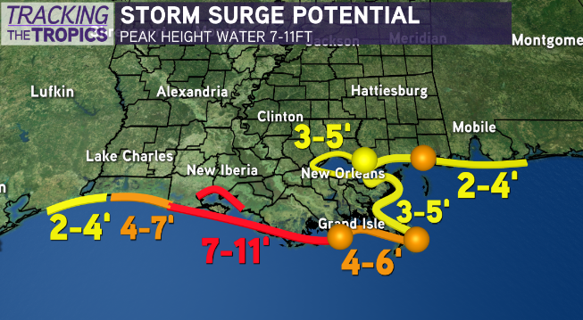
The highest storm surge right now looks to be from Grand Isle west through the Atchafalaya. These areas could see 7 to 11 feet of surge which would be an issue, and could also cause high water to extend well inland from the coast. If you are outside the levee system and told to evacuate please do so.
The rest of the area will see similar levels to other storms this season. Expect areas outside the levee system to get several feet of water but nothing too abnormal.

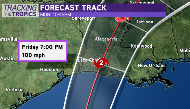
The forecast track as of Wednesday night remains basically unchanged with a landfall point between Pecan Island and Cameron as a category 2 storm. This should keep the strongest wind west of our viewing area although gusts into the 40s and 50s are possible especially west of New Orleans.
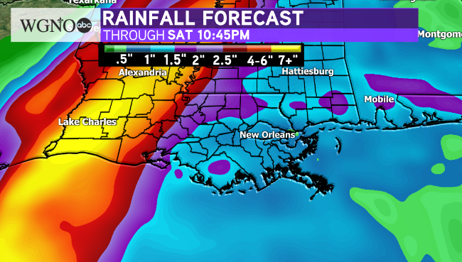
Rain amounts still look to be on the low side.

Much higher amounts are likely west near the center, but for southeast Louisiana and southern Mississippi it looks to be around 1-3 inches at most. Higher amounts would be possible with any heavy band that moves slowly.
As it stands the coastal flooding and storm surge threat will continue to be the main issues. Please make plans now to stay safe in those areas.
As always stay with us here on WGNO on air and online.


