—
10:00 PM
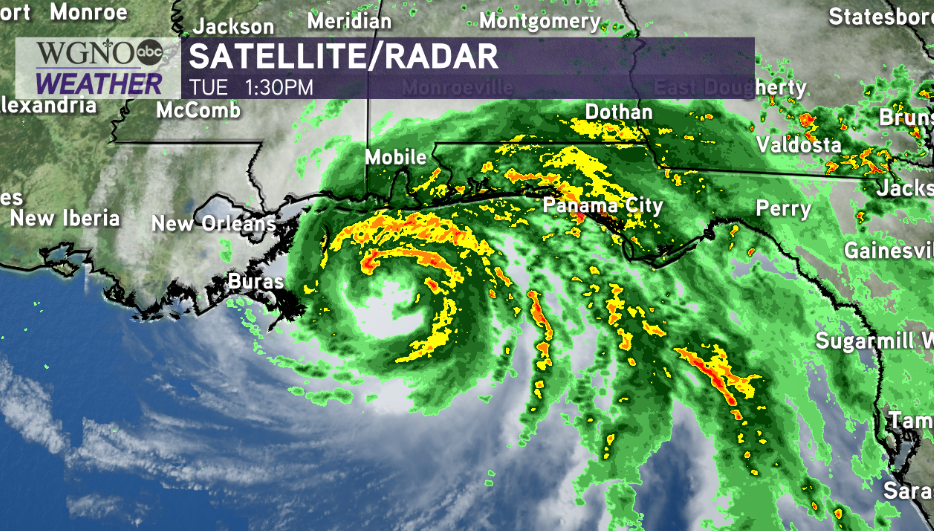
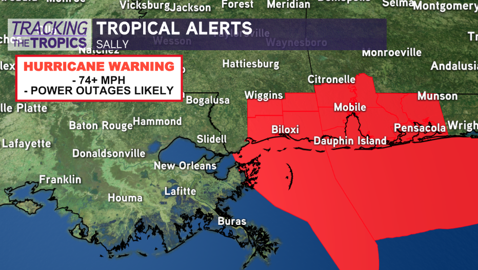
Hurricane Sally is actually strengthening a bit as it creeps toward the coast. Winds are up to 85 mph. It will be a long night with a lot of power outages, flooding, and wind damage for areas to the east. Locally just a breezy day with upper 80s on Wednesday.
—
4:00 PM
What a difference 48 hours can make as Hurricane Sally now poses greatest threats across the Alabama, Florida coastlines late tonight to early Wednesday. We, here, in New Orleans are very fortunate for having dodged another bullet.
Our main issue is going to be coastal surge locally based off of an increasingly eastern track shift. Anticipate 2-4 feet of surge in Lake Pontchartrain and Lake Maurepas but 4-7 feet of surge along the coastline. This is not a concern for any flooding near areas within the levee protection system.

New Orleans will see a few tropical showers today, and rain chances locally will be between a quarter of an inch to an inch in the metro and 2-3 inches along the coast. Winds will likely only feel breezy, as all tropical storm watches and hurricane watches for our local area are no longer in effect.

Elsewhere, it will be a different story, though, as slow-moving Sally will bring flash flooding, longer duration wind impacts, and significant storm surge along and east of where the center comes ashore.
Historic rainfall is possible in south Alabama and along the Florida panhandle. The Weather Prediction Center shows 12 to 20+ inches in rainfall totals possible. The National Weather Service office in Mobile is mentioning some localized spots could receive an isolated 30 inches of rain from this system.
The latest National Hurricane Center Advisory now has Sally moving northwest at 2 miles per hour with 85 mile per hour wind speeds. Sally will likely make landfall as a Category 1 hurricane along the Alabama Gulf Coast early Wednesday morning.


