Tropical Depression Nineteen has formed, and the National Hurricane Center is forecasting for this system to reach maximum sustained winds of 70 miles per hour before making landfall somewhere along the Central Gulf Coast next week as Tropical Storm Sally.
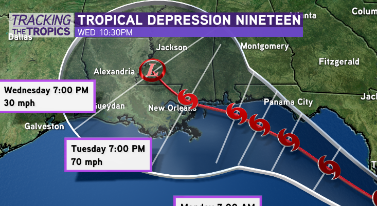
This is likely moving into the Gulf of Mexico Saturday. Residents from Louisiana to Florida should remain informed as well as vigilant while potential impacts will be becoming more defined. Evening model guidance develops Nineteen as a moderate tropical storm moving towards our Central Gulf Coast (Florida Panhandle – South Louisiana) by Monday or Tuesday. Most model guidance trends illustrate the system does stay relatively weak, evolving as a big time rain maker for someone.
However, models’ projected intensity of this system could easily be under-performing. It’s tough to rule out the system outdoing current model guidance, achieving moderate or stronger tropical storm, maybe even low end hurricane strength, once in the Gulf of Mexico. Environmental conditions are decently favorable with hot water temperatures, and minimal dry air or wind shear.
Keep up with the unfolding developments this weekend. Forecast models will handle the system’s strength poorly until it actually materializes, not to mention, any tropical system nearby during September must be watched closely as this is the climatological peak of hurricane season.
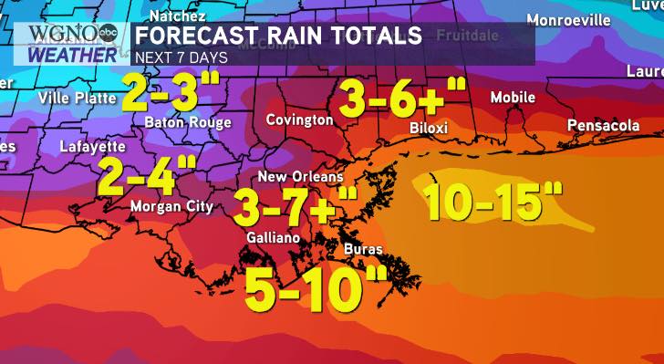
Overall, steering currents appear weak by early next week. This means the system could be moving SLOW. Regardless of whether the system develops into bonafide tropical storm, an unsettled weather pattern appears likely through next Wednesday. Periods of localized heavy rainfall will be likely, especially early next week. Expect 3-6+ inches in total south of I-10 throughout southeast Louisiana, with localized higher amounts likely.
Latest Weather Prediction Center rainfall projections show hot spots of 10-15 inches of rain over the next 7 days for localized spots along and east of where the center of the system moves onshore. Take projected rain totals with a big grain of salt, as they will undoubtedly be fine tuned once we gain confidence in this systems’ projected strength and path.
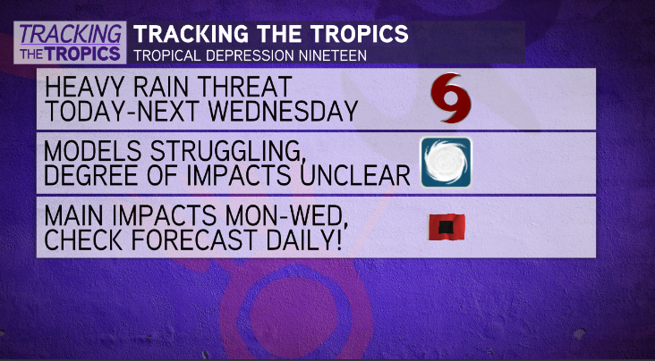
Start simple preparations. Clearing storm drains, reviewing hurricane preparation plans, restocking supplies. We should be prepared by now, as this is the 4th system to threaten Louisiana this season.


