Well, we’ll be beginning to sound like broken records given consecutive blazing high temperatures each afternoon this week!
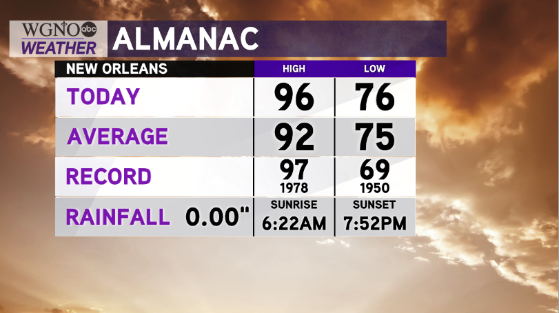
Today, we were just a single degree away from our standing one set August 3, 1978.
Earlier, New Orleans International Airport reached 96 degrees, and that same trend remains within our forecast for 24 more hours.
Based off of ridging high pressure, conditions stay excessively hot with afternoon heat indices in the 100-105 range through at least Thursday.
Any brief relief will come alongside scattered thunderstorm development, threatening scattered rain in neighborhoods, lightning, gusty winds, etc. Have ways you can receive watch information on hand.
Gulf of Mexico waters are quiet, too, as National Hurricane Center Meteorologists currently monitor no development chances these next five days.
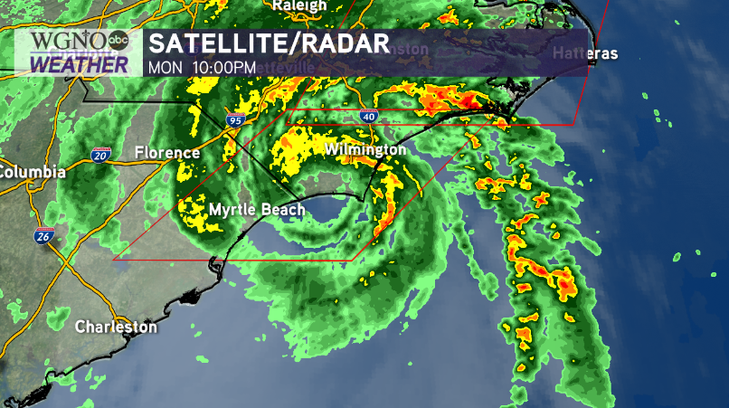
Hurricane Isaias is continually gaining strength. It officially made landfall in Ocean Isle Beach at 11:10 PM EST near the North Carolina, South Carolina border and will continue inland up America’s East Coast through Maine.
Further east, National Hurricane Center meteorologists keep watching moderate chances for formation because tropical waves continue rolling into open Atlantic waters. Right now, no local threats or impacts are expected.
Finishing outdoor exercise sooner than later will be best since temperatures skyrocket quickly.
Don’t forget also staying hydrated, especially when outside with any pets as asphalt heats up well beyond actual temperatures during summertime locally. Never ever leave them or children unattended inside vehicles.


