VIDEO FORECAST from Meteorologist Scot Pilie — Heavy rainfall beginning to move into southeast Louisiana. Heavy rainfall, coastal flooding, and wind impacts likely with Cristobal. Here’s the extended video update:
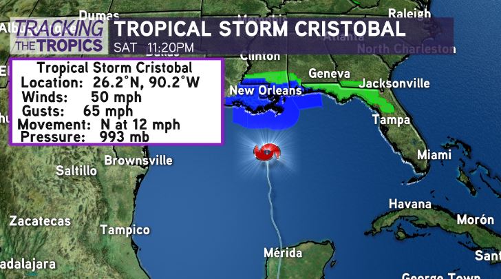
Latest 10PM NHC Update — No change to track or strength of Cristobal. Max sustained winds of 50mph, gusting to 65mph.
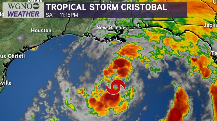
System starting to develop more thunderstorms near the center of circulation, which may help system gain some strength tonight-tomorrow before landfall.
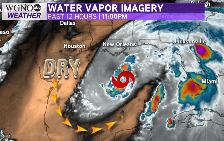
Thankfully, dry air is still impeding any quick intensification.
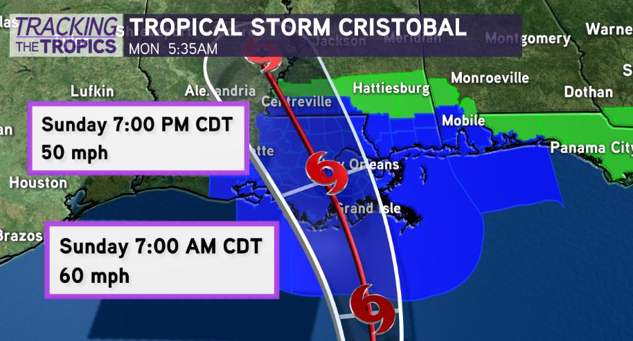
Expected to make landfall as strong tropical storm in Terrebonne Parish Sunday afternoon-evening. Greatest impacts along and east of center.
The system remains heavily lopsided with most of the action on the eastern side due to dry air intrusion. However, as moisture slowly wraps around the system tonight-tomorrow, I still believe there is a 24 hour window for continued strengthening until landfall.

Regardless of exact wind strength, growing more concerned of a significant rainfall event for areas east of where Tropical Storm Cristobal comes ashore. The Weather Prediction Center has raised the “Excessive Rainfall Outlook” to a Moderate(Level 3 out of 4) for southeast Louisiana & south Mississippi.

A Moderate Risk means there is a 20-50% chance rainfall could EXCEED flash flood guidance, meaning even more than model data is projecting. It wouldn’t surprise me to see some areas receive 12+ inches of rainfall tonight-Monday.
The key? Not everyone will see the 12+ inches of rain! Some spots may see 4-5″ while just 20 miles away they see 8-12″. It will only be the spots that see the “training” of rain bands, which is nearly impossible to predict.
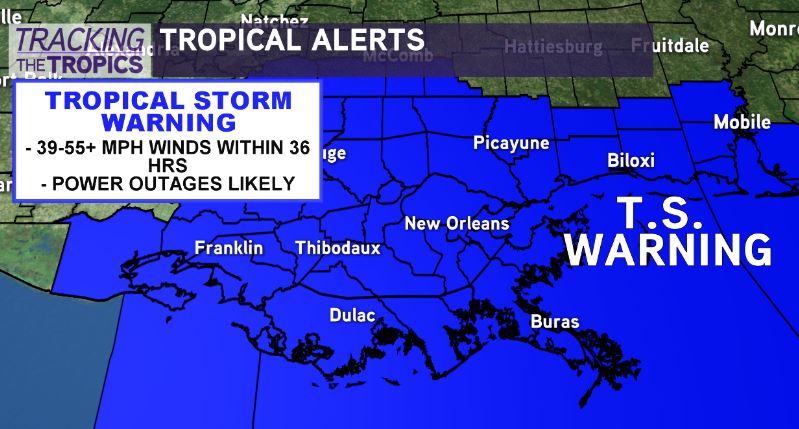
Tropical Storm Warnings flying from Vermilion Parish to the Florida Panhandle, which encompasses all of southeast Louisiana.
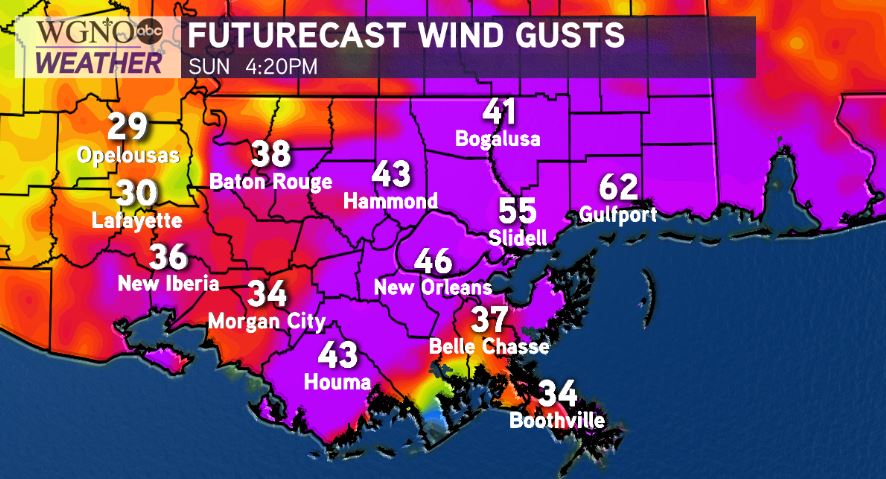
30-55mph winds likely within the TS Warning, with numerous power outages possible.
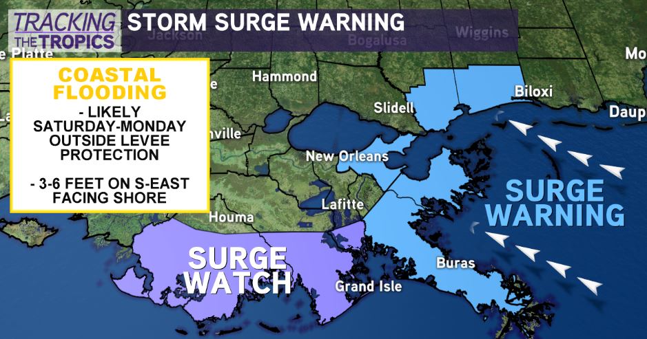
Storm surge of 2-5 feet likely outside levee system from Mouth of Mississippi River to Ocean Springs, Mississippi. 1-3 feet inside Lake Pontchartrain/Maurepas.
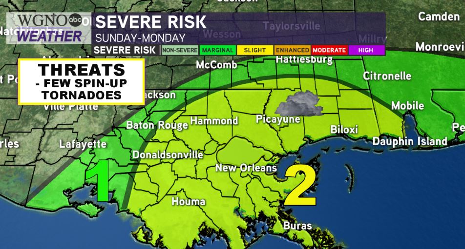
Isolated tornado threat with eastern rain bands, especially late Sunday-Monday morning.

More details to come later today! Finish preparations. Primary impacts will arrive Sunday-Sunday night and flash flood threat will continue through Monday.


