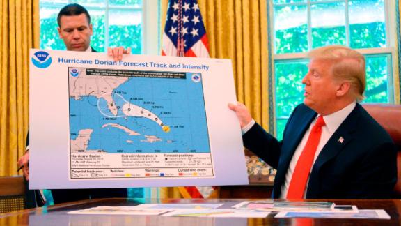
President Trump appeared to show an altered map of Hurricane Dorian’s trajectory in the Oval Office that added the state of Alabama to the storm’s projected path.
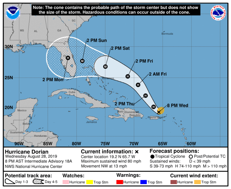
Trump’s apparently altered map appears to be based on a projection map issued by the National Weather Service on August 28 that did not include Alabama:
At 8 pm Hurricane Dorian was located 60 mi NNW of San Juan Puerto Rico moving to the NW @ 13 mph with max winds of 80 mph. Gradual strengthening is expected the next few days as Dorian continues to track to the NW over the Atlantic well east of the southeast & central Bahamas. pic.twitter.com/aDqrJDEf0g
— NWS Eastern Region (@NWSEastern) August 29, 2019


On September 1, the president tweeted that the storm was forecast to hit Alabama, a false claim that was quickly refuted by the National Weather Service:
In addition to Florida – South Carolina, North Carolina, Georgia, and Alabama, will most likely be hit (much) harder than anticipated. Looking like one of the largest hurricanes ever. Already category 5. BE CAREFUL! GOD BLESS EVERYONE!
— Donald J. Trump (@realDonaldTrump) September 1, 2019
Alabama will NOT see any impacts from #Dorian. We repeat, no impacts from Hurricane #Dorian will be felt across Alabama. The system will remain too far east. #alwx
— NWS Birmingham (@NWSBirmingham) September 1, 2019
President @realDonaldTrump gives an update on Hurricane #Dorian: pic.twitter.com/CmxAXHY5AO
— The White House (@WhiteHouse) September 4, 2019
CNN has reached out to the White House for comment and has not heard back.


